Port Wing, Wisconsin
Port Wing (also Portwing) is an unincorporated census-designated place in the town of Port Wing, Bayfield County, Wisconsin, United States.[1][2] The community is along Wisconsin Highway 13 and Bayfield County Highway A. It is 30 miles (48 km) west of Bayfield. The Flag River enters Lake Superior at Port Wing's harbor.[3]
Port Wing, Wisconsin | |
|---|---|
 | |
 Port Wing | |
| Coordinates: 46°46′29″N 91°23′12″W | |
| Country | United States |
| State | Wisconsin |
| County | Bayfield |
| Town | Port Wing |
| Area | |
| • Total | 1.150 sq mi (2.98 km2) |
| • Land | 1.150 sq mi (2.98 km2) |
| • Water | 0 sq mi (0 km2) |
| Elevation | 676 ft (206 m) |
| Population (2010) | |
| • Total | 164 |
| • Density | 140/sq mi (55/km2) |
| Time zone | UTC-6 (Central (CST)) |
| • Summer (DST) | UTC-5 (CDT) |
| ZIP code | 54865 |
| Area code(s) | 715 and 534 |
| GNIS feature ID | 1571798[1] |
Population
As of the 2010 census, its population is 164.[4] Port Wing has an area of 1.150 square miles (2.98 km2), all of it land.
Education
Port Wing is the site of South Shore School District.[5]
Notable people
- Megan Gustafson, 2019 Naismith Award winner and two-time Big Ten Conference Women's Basketball Player of the Year at the University of Iowa, was raised from infancy in Port Wing (though born in a Duluth, Minnesota hospital).
- Gary Sherman, politician and jurist, lived in Port Wing.[6]
Notes
- "Port Wing, Wisconsin". Geographic Names Information System. United States Geological Survey.
- Hometownlocator.com
- "Wisconsin Department of Transportation-Bayfield County, Wisconsin" (PDF). Archived from the original (PDF) on 2008-05-16. Retrieved 2014-09-06.
- "U.S. Census website". U.S. Census Bureau. Retrieved 19 April 2011.
- South Shore School District
- Votesmart.org.-Gary Sherman
gollark: I see a 403 on my end.
gollark: Check your perms.
gollark: I see your message here however.
gollark: It is done, maybe.
gollark: ABR doesn't see it/has no access?
External links
Municipalities and communities of Bayfield County, Wisconsin, United States | ||
|---|---|---|
| Cities | 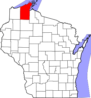 | |
| Village | ||
| Towns | ||
| CDPs | ||
| Unincorporated communities | ||
| Indian reservation | ||
| Footnotes | ‡This populated place also has portions in an adjacent county or counties | |
This article is issued from Wikipedia. The text is licensed under Creative Commons - Attribution - Sharealike. Additional terms may apply for the media files.