Poole County
Poole County is one of the 141 Cadastral divisions of New South Wales. It is located in the extreme north-west of the state, abutting Cameron Corner. It includes parts of Sturt National Park.
| Poole New South Wales | |||||||||||||||
|---|---|---|---|---|---|---|---|---|---|---|---|---|---|---|---|
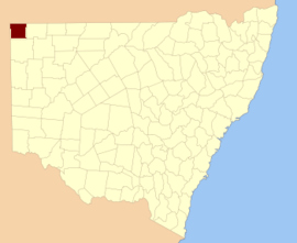 Location in New South Wales | |||||||||||||||
| |||||||||||||||
Poole County was named in honour of James Poole (explorer), (born?-1845), Charles Sturt's second-in-command.[1]
Parishes within this county
A full list of parishes found within this county; their current LGA and mapping coordinates to the approximate centre of each location is as follows:
| Parish | LGA | Coordinates |
|---|---|---|
| Blackwood | Unincorporated | 29°34′51″S 141°08′05″E |
| Fort Grey | Unincorporated | 29°17′31″S 141°03′07″E |
| Lang | Unincorporated | 29°30′25″S 141°31′10″E |
| Mount King | Unincorporated | 29°02′40″S 141°41′46″E |
| Mount Poole | Unincorporated | 29°32′40″S 141°41′11″E |
| Nantomoko | Unincorporated | 29°21′43″S 141°08′05″E |
| Patterson | Unincorporated | 29°35′41″S 141°21′10″E |
| Pinaroo | Unincorporated | 29°08′04″S 141°06′55″E |
| Stewart | Unincorporated | 29°29′37″S 141°08′05″E |
| Sturt | Unincorporated | 29°25′59″S 141°31′11″E |
| Tindara | Unincorporated | 29°12′51″S 141°29′26″E |
| Yarraba | Unincorporated | 29°12′59″S 141°11′13″E |
gollark: Horrible suffering, why?
gollark: I don't read my diffs because I know what things I did, see.
gollark: What of them?
gollark: I am not.
gollark: This was actually all part of my plan to make your projects fail by distracting you with moderately problematic python.
References
- "Poole County". Geographical Names Register (GNR) of NSW. Geographical Names Board of New South Wales.

This article is issued from Wikipedia. The text is licensed under Creative Commons - Attribution - Sharealike. Additional terms may apply for the media files.