Parish of Fort Grey
Fort Grey, is a remote civil parish of Poole County in far North West New South Wales.[1][2] located at 29.1731°S 141.0307°E.

Geography
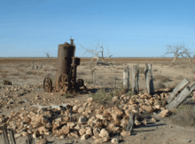
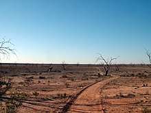
The Geography, of Fort Grey is mostly the flat, arid landscape of the Channel Country but includes Lake Pinaroo.
The parish is to the west of the Silver City Highway and lies entirely within the Sturt National Park.[3]
The Queensland-New South Wales border forms the northern boundary of the parish, which is marked by The Dingo Fence.[4] The parish has a Köppen climate classification of BWh (Hot desert)[5]. The County is barely inhabited with a population density of less than 1 person per 150km² and the landscape is a flat arid scrubland.
History
The Parish is on the traditional lands of the Wandruwandha[6] Aboriginal peoples.[7]
Charles Sturt passed by the parish during 1845,[8] and Charles Sturt camped in the Fort Grey during 1845.
In 1861 the Burke and Wills expedition passed to the east.[9] through what is now the Pindera Aboriginal Area.[10]
Gold was discovered nearby in the 1870s, and the miners were soon followed by pastoralists. [11]
 Landscape of Fort Grey
 the Sturt Tree, marked by Charles Sturt on his exploration
- Dry bed of Lake Pinaroo
- Camping site Fort Grey.
References
- "Poole County". Geographical Names Register (GNR) of NSW. Geographical Names Board of New South Wales.

- / Map of the County of Poole : Western Division, ,
- Olive Downs campground.
- Sturt National Park, Outback NSW.
- Peel, M. C.; Finlayson, B. L.; McMahon, T. A. (2007). "Updated world map of the Köppen–Geiger climate classification". Hydrol. Earth Syst. Sci. 11: 1633–1644. doi:10.5194/hess-11-1633-2007. ISSN 1027-5606. (direct: Final Revised Paper)
- Aboriginal Heritage Corner Country History & Heritage Archived 1 March 2018 at the Wayback Machine.
- David R Horton (creator), © Aboriginal Studies Press, AIATSIS, and Auslig/Sinclair, Knight, Merz, 1996.
- Sturt's Central Australian Expedition Archived 1 March 2018 at the Wayback Machine.
- The Burke and Wills Expedition Archived 1 March 2018 at the Wayback Machine,
- NSW National Parks and Wildlife service, Draft Plan of Management Sturt National Park, (2017) p 22.
- NSW National Parks and Swildlife service, Draft Plan of Management Sturt National Park, (2017) p 22.