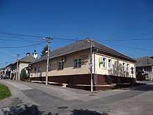
Pohorelá
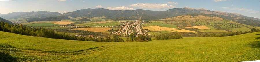
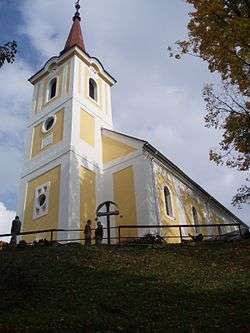
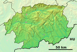
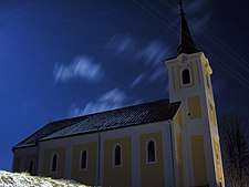
Pohorelá (Hungarian: Koháryháza) is a village and municipality in the Brezno District, of the Banská Bystrica Region of central Slovakia. It is located in the foothills of the Low Tatras range of the Carpathian Mountains, on the right bank of the upper Hron River. The village is located 33 km east of Brezno, 49 km southwest of Poprad, and 37 km north of Tisovec on First Class Road 66. Pohorelá is the third largest village of the Horehronie region. The Roman Catholic Pohorela church, built in 1762, is a dominant feature of the village.
Pohorelá | |
|---|---|
Village | |
 | |
 Flag  Coat of arms | |
 Pohorelá Location of Pohorelá in the Banská Bystrica Region  Pohorelá Pohorelá (Slovakia) | |
| Coordinates: 48°51′55″N 20°01′06″E | |
| Country | Slovakia |
| Region | Banská Bystrica |
| District | Brezno |
| First mentioned | 1612 |
| Government | |
| • Mayor | Jana Tkáčiková |
| Area | |
| • Total | 46.94 km2 (18.12 sq mi) |
| Elevation | 764 m (2,507 ft) |
| Population (2004-12-31) | |
| • Total | 2,552 |
| • Density | 54/km2 (140/sq mi) |
| Time zone | Central European Time |
| Postal code | 976 69 |
| Area code(s) | +421-48 |
| Car plate | BR |
| Website | www.pohorela.sk |
Topography
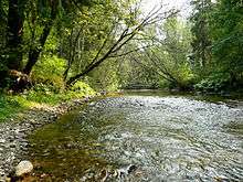
Pohorelá lies on the right bank of the Hron , on the edge of the Low Tatras.[1] On the left bank of the Hron, the Vepor Mountains rise steeply, forming a subrange of the Slovak Ore Mountains; the area is part of the Muránska Planina National Park. The entire right bank of the Hron is part of the protection zone of the Low Tatras National Park.[2]
Important geographical points in the vicinity of the village are Ždiar Saddle , Orlová Peak , Andrejcová Hill , Mašianske skalky nature reserve and the Pohorelá uplands. At the upper end of the village are mineral water springs.
History
A long distance road between the Spiš and Horehronie regions has passed through the valley since antiquity. A rare archaeological finding of a barbarian hoard from the Early Iron Age (Balas 1960,70) is recorded in the town's cadastre - probably an excavation of the Puchov culture. The village was founded at the beginning of the seventeenth century under the Vlach law. The oldest written mention of the village dates back to 1612. The indigenous people were engaged in shepherding and wood processing. In the eighteenth century, iron ore mines were opened and an ironworks was built. The construction of houses for workers of the Pohorelá ironworks established the current neighboring settlement, Pohorelská Maša. In about 1830, ownership of the ironworks passed to Prince Ferdinand of Saxe-Coburg and Gotha, and the administration was moved to Pohorelá. After extensive modernization, the Pohorelá complex became the most important iron producer in what was then the Hungarian county of Gömör és Kishont. By 1844, the industrial complex along the Hron River consisted of 2 smelters, 15 forges, 3 sheet rolling mills, and 2 iron bar rolling mills.
The area was long a part of the Hungarian half of the Austro-Hungarian Empire. The independence of Czecho-Slovakia was first announced in Pohorelá on or about the 30th of October, 1918. Though a civic guard was formed, the village experienced some instability over the following months. The first elections for the National Assembly took place in 1920, with the Slovak National Party winning the majority of votes in the village.[3]
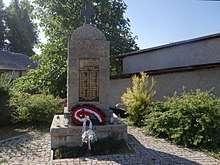
During the Slovak National Uprising (SNP), partisans of the Katrušinov section of the Jánošík Brigade - named for the 18th century Slovak highwayman, Juraj Jánošík - were active in the vicinity of Pohorelá. The village was occupied by German and Hungarian troops in late 1944. The Romanian army liberated Pohorelá on January 29, 1945.
Notable residents
- Vladimír Clementis, frequent visitor, Communist politician, Foreign Minister of Czecho-Slovakia 1948-1950
- Pavol Dobšinský, Slovak folklorist and author of the Romantic era
- Jozef Gregor-Tajovský,prose and drama author, poet, teacher and politician
- Martin Rázus, poet, dramatist, writer, politician, and Lutheran priest[4]
- Prince August of Saxe-Coburg and Gotha, ran Pohorelá ironworks
- Prince Ferdinand of Saxe-Coburg and Gotha, owned and modernized Pohorelá ironworks
- Ferdinand I of Bulgaria, maintained a summer residence in Pohorelská Maša
- Prince Philipp of Saxe-Coburg and Gotha, visited frequently on hunting trips
- Max Švabinský, painter, draughtsman, graphic artist, and professor
Picture gallery

References
- KOČICKÝ, Dušan; IVANIC, Boris. Geomorphological division of Slovakia [online]. Bratislava: State Geological Institute Dionýz Štúr, 2011, [cit. 2018-06-19]. Available online.
- map portal HIKING.SK [online]. mapy.hiking.sk, [cit. 2018-08-14]. Available online.
- History of Village Pohorelá Official Municipal Webpage
- Artist profile
External links
- Official website Pohorelá
- Official website of parish Pohorelá
- Pohorelá - History
- Banskobystrický samosprávny kraj Official website of the Banská Bystrica region
- Official Facebook page for HK Pohorelá
Municipalities of Brezno District | ||
|---|---|---|