Playa del Carmen
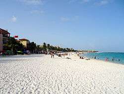
Playa del Carmen (Spanish pronunciation: ['plaʝa ðel 'kaɾmen]) is a city located along the Caribbean Sea in the municipality of Solidaridad, in the state of Quintana Roo, Mexico. It is a popular tourist area in eastern Mexico. Playa del Carmen features a wide array of tourist activities due to its geographical location in the Riviera Maya. It has also been the destination of PGA Tour golf tournaments and the set location for various television shows. The town has one of the fastest-growing populations in Mexico.
Playa del Carmen | |
|---|---|
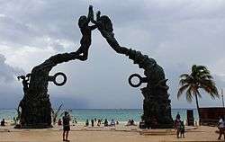 Playa del Carmen, Quintana Roo | |
| Nickname(s): Playa, PDC | |
 Playa del Carmen | |
| Coordinates: 20°37′39″N 87°04′52″W | |
| Country | Mexico |
| State | Quintana Roo |
| Municipality | Solidaridad |
| Founded | 1937 |
| Government | |
| • Mayor | Laura Beristáin Navarrete 2018–2021 (MORENA) |
| Elevation | 10 m (30 ft) |
| Population (2018[1]) | |
| • City | 252,087 |
| • Urban | 252,087 |
| Demonym(s) | Playense |
| Time zone | UTC-5 (Southeast (US Eastern)) |
| Postal codes | 77710, 77720 |
| Area code(s) | 984 |
| Website | gobiernodesolidaridad |
Geography
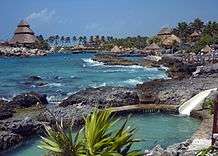
Playa del Carmen is located within the Riviera Maya, which runs from south of Cancún to Tulum and the Sian Ka'an biosphere reserve. Playa is a stop for several cruise ships which dock at the nearby Calica quarry docks, about six miles (10 km) south of the city. The Xcaret Eco Park, a Mexican-themed "eco-archaeological park", is a popular tourist destination located just south of the town in Xcaret (pronounced "ish-kar-et").
Climate
In October 2005, Hurricane Wilma passed directly over Playa del Carmen, remaining in the vicinity for two days and causing significant damage and a temporary drop in tourist arrivals. Most of the damage was relatively superficial and repaired within a few weeks of the storm. Hurricane Wilma arrived from the Caribbean Sea, passing over Cozumel before making landfall in Playa del Carmen. It then moved north along the Mexican coast, hitting Cancún especially hard.
| Climate data for Playa del Carmen (1951–2010) | |||||||||||||
|---|---|---|---|---|---|---|---|---|---|---|---|---|---|
| Month | Jan | Feb | Mar | Apr | May | Jun | Jul | Aug | Sep | Oct | Nov | Dec | Year |
| Record high °C (°F) | 37.5 (99.5) |
33.0 (91.4) |
34.0 (93.2) |
39.0 (102.2) |
40.0 (104.0) |
39.0 (102.2) |
39.0 (102.2) |
39.5 (103.1) |
39.0 (102.2) |
34.0 (93.2) |
35.0 (95.0) |
39.0 (102.2) |
40.0 (104.0) |
| Average high °C (°F) | 27.8 (82.0) |
28.5 (83.3) |
29.6 (85.3) |
30.8 (87.4) |
31.7 (89.1) |
32.0 (89.6) |
32.5 (90.5) |
32.9 (91.2) |
32.6 (90.7) |
30.8 (87.4) |
29.3 (84.7) |
28.6 (83.5) |
30.6 (87.1) |
| Daily mean °C (°F) | 22.8 (73.0) |
23.4 (74.1) |
24.3 (75.7) |
26.1 (79.0) |
27.3 (81.1) |
27.9 (82.2) |
28.0 (82.4) |
28.0 (82.4) |
27.9 (82.2) |
26.3 (79.3) |
24.4 (75.9) |
23.4 (74.1) |
25.8 (78.4) |
| Average low °C (°F) | 17.9 (64.2) |
18.3 (64.9) |
19.0 (66.2) |
21.3 (70.3) |
22.9 (73.2) |
23.7 (74.7) |
23.5 (74.3) |
23.2 (73.8) |
23.1 (73.6) |
21.7 (71.1) |
19.4 (66.9) |
18.2 (64.8) |
21.0 (69.8) |
| Record low °C (°F) | 8.0 (46.4) |
7.0 (44.6) |
5.0 (41.0) |
10.0 (50.0) |
15.0 (59.0) |
14.0 (57.2) |
13.0 (55.4) |
15.0 (59.0) |
14.0 (57.2) |
13.5 (56.3) |
11.0 (51.8) |
9.0 (48.2) |
5.0 (41.0) |
| Average rainfall mm (inches) | 61.2 (2.41) |
50.5 (1.99) |
28.1 (1.11) |
51.2 (2.02) |
78.1 (3.07) |
153.0 (6.02) |
126.3 (4.97) |
126.3 (4.97) |
168.8 (6.65) |
284.3 (11.19) |
130.3 (5.13) |
73.1 (2.88) |
1,331.2 (52.41) |
| Average rainy days (≥ 0.1 mm) | 7.7 | 4.4 | 3.8 | 3.7 | 6.5 | 10.6 | 9.3 | 9.6 | 14.5 | 15.9 | 9.5 | 7.3 | 102.8 |
| Source: Servicio Meteorológico Nacional[2] | |||||||||||||
Demographics
| Year | Pop. | ±% |
|---|---|---|
| 1995 | 17,621 | — |
| 2000 | 43,613 | +147.5% |
| 2005 | 100,383 | +130.2% |
| 2010 | 149,923 | +49.4% |
| 2014 | 186,700 | +24.5% |
| sources:[3] | ||
Tourism
Originally a small fishing town, tourism to Playa del Carmen began with the passenger ferry service to Cozumel, an island across the Cozumel Channel and a world-famous scuba diving destination.
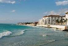
Playa del Carmen has recently undergone extremely rapid development with new luxury residential condominium buildings, restaurants, boutiques, and entertainment venues. Tourist activity in Playa del Carmen centers on Quinta Avenida, or Fifth Avenue, which stretches from Calle 1 norte to Calle 40. A pedestrian walkway located just one or two blocks inland from the beach, Fifth Avenue is lined with hundreds of shops, bars, and restaurants. There are many small boutique hotels on and just off Fifth Avenue and on the beach.
Playacar is a residential and tourist development in Playa del Carmen just south of the main urban area. Most of the all-inclusive hotels, the aviary, and the golf course are located in this development. There are two phases – phase 1 is mostly residential with a few hotels and some stores, while phase 2 contains the largest all-inclusive resorts as well as the golf course and a significant number of residential properties.
Playa del Carmen is host to several major annual events.
Sports
The city is home to Inter Playa del Carmen, an association football club founded in 1999, which competes in the south group of the Segunda División Profesional, the third tier of Mexican football league system.
The Mayakoba Golf Classic is a PGA Tour FedEx Cup golf tournament held at El Camaleón Golf Club since 2007. Since 2013, it has been a full-points tournament where the winner earns full rights for a PGA TOUR win.
In popular culture
The telenovela Peregrina takes place in Playa del Carmen. The Real Housewives of Vancouver featured Playa del Carmen in two episodes. The Amazing Race was shot on location in Playa del Carmen. The Celebrity Mole was set in the Playa del Carmen area. UK reality series Geordie Shore featured Playa del Carmen. It was also seen in Spies in Disguise.
Notable residents
Notable residents include the following:
- WSOP winner Barry Shulman
- DJ David Guetta
- Fashion designer Tory Burch
- Actress Ana Claudia Talancón
References
- "2018 census". riviera-maya-news.com.
- "Estado de Quintana Roo-Estacion: Playa del Carmen". Normales Climatologicas 1951–2010 (in Spanish). Servicio Meteorológico Nacional. Retrieved 1 August 2015.
- "MEXICO: Quintana Roo". Citypopulation.de. 2015-01-08. Retrieved June 1, 2015.
External links
| Wikimedia Commons has media related to Playa del Carmen. |

- Playa del Carmen at Curlie
