Piz Argient
Piz Argient (3,945 m) is a mountain in the Bernina Range of the Alps on the border between Italy and the Swiss canton of Graubünden.
| Piz Argient | |
|---|---|
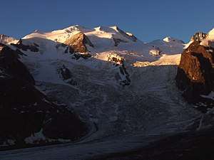 Bellavista (left and centre), Piz Argient (snowy dome, right) and Crast' Agüzza (rocky peak, extreme right) | |
| Highest point | |
| Elevation | 3,945 m (12,943 ft) |
| Prominence | 99 m (325 ft) [1] |
| Parent peak | Piz Zupò |
| Isolation | 0.5 km (0.31 mi) |
| Coordinates | 46°21′57.28″N 9°55′30.9″E |
| Naming | |
| English translation | Silver peak |
| Geography | |
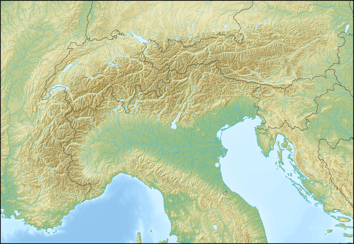 Piz Argient Location in the Alps | |
| Location | Italy / Switzerland |
| Parent range | Bernina Range |
| Geology | |
| Mountain type | Granite |
| Climbing | |
| First ascent | 1869 by Seiler and von Seldeneck, with guides Christian Grass, J. B. Walther and a chamois hunter |
| Easiest route | North-east ridge from the Fuorcla dal Zupò (F) |
The peak is bounded to the north by the Morteratsch Glacier, to the west by the Upper Scerscen Glacier, and to the south and east by the Fellaria Glacier. It is separated from Piz Zupò to its east by the Fuorcla dal Zupò (3,851 m) and from Crast' Agüzza to its north-west by the Fuorcla da l'Argient (3,705 m).
Huts
- Marco e Rosa Hut (3,610 m)
- Marinelli Hut (2,813 m)
gollark: If a drone is going around ramming you you can just scrench it. If a drone drops HECf-251 on you, it can go high enough that you can't see it, drop it once, and fly away before you know what happened.
gollark: Yes, and it's very hard to defend against.
gollark: It has radars. By default those can only get your distance, but there's an option for providing coords and trilateration is a thing.
gollark: Computronics does, though.
gollark: That's a fair point. I don't think OC has stuff for that.
External links
This article is issued from Wikipedia. The text is licensed under Creative Commons - Attribution - Sharealike. Additional terms may apply for the media files.