Pitiquito Municipality
Pitiquito Municipality is a municipality in Sonora in north-western Mexico.[1]
Pitiquito Municipality | |
|---|---|
| Coordinates: 30°40′38″N 112°3′18″W | |
| Country | |
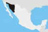
| State | Sonora |
| Time zone | UTC-7 (Mountain Standard Time) |
| • Summer (DST) | UTC-7 (No DST) |
Neighboring municipalities
Neighboring municipalities are Altar to the northwest, Hermosillo to the south, Trincheras to the east, and Caborca and the Gulf of California to the west. The town of Pitiquito is located in the north of the municipality on Federal Highway 2.
gollark: *has an IOU for 30 reds now but won't get them for a while*
gollark: *somehow also has free reds and really ought to incubate more*
gollark: Well, yes, but influence.
gollark: Checkers are more effort than PB prizes? I'm pretty sure the second one involves more waiting.
gollark: ***influence***
References
- "-". Enciclopedia de los Municipios de México. Instituto Nacional para el Federalismo y el Desarrollo Municipal. Retrieved January 4, 2010.
This article is issued from Wikipedia. The text is licensed under Creative Commons - Attribution - Sharealike. Additional terms may apply for the media files.