Pine Level, Montgomery County, Alabama
Pine Level, also known as Pine Tucky, is an unincorporated community in Montgomery County, Alabama, United States. Pine Level is located along U.S. Route 231 (also known as Alabama State Route 53), 25 miles (40 km) southeast of Montgomery.
Pine Level, Alabama | |
|---|---|
 Pine Level, Alabama  Pine Level, Alabama | |
| Coordinates: 32°04′05″N 86°03′35″W | |
| Country | United States |
| State | Alabama |
| County | Montgomery |
| Elevation | 489 ft (149 m) |
| Population (2007) | |
| • Total | 1,782 |
| Time zone | UTC-6 (Central (CST)) |
| • Summer (DST) | UTC-5 (CDT) |
| ZIP code | 36069 |
| Area code(s) | 334 |
| GNIS feature ID | 152926[1] |
History
Pine Level was originally known as Pine Tucky, most likely due to its location on poor sandy soil covered with pine trees. The community later began to be called Pine Level.[2] A post office first opened under the name Pine Level in 1839.[3]
Notable person
- Rosa Parks, her arrest served as a catalyst to the Montgomery bus boycott during the Civil Rights Movement. She lived in Pine Level as a child.
gollark: [REDACTED UNDER φ-152 PROTOCOLS]
gollark: I'm trying to implement a PID controller for controlling rotation of a robot. As I don't have it with me, this is a very rough simulation.
gollark: PV, error, output, integ and deriv. This is highly clear.
gollark: Well, if it was cool and good™, it would bring the blue line closer to -5 without the green line wildly oscillating.
gollark: It appears that my code may have problems.
References
- "Pine Level". Geographic Names Information System. United States Geological Survey.
- Foscue, Virginia (1989). Place Names in Alabama. Tuscaloosa: The University of Alabama Press. p. 111. ISBN 0-8173-0410-X.
- "Montgomery County". Jim Forte Postal History. Retrieved 18 January 2015.
Municipalities and communities of Montgomery County, Alabama, United States | ||
|---|---|---|
| Cities | 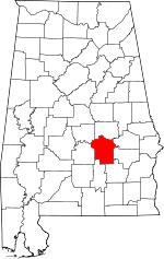 Map of Alabama highlighting Montgomery County | |
| Towns | ||
| Unincorporated communities | ||
| Indian reservation | ||
| Footnotes | ‡This populated place also has portions in an adjacent county or counties | |
This article is issued from Wikipedia. The text is licensed under Creative Commons - Attribution - Sharealike. Additional terms may apply for the media files.