Pidigan
Pidigan, officially the Municipality of Pidigan (Ilocano: Ili ti Pidigan; Tagalog: Bayan ng Pidigan), is a 5th class municipality in the province of Abra, Philippines. According to the 2015 census, it has a population of 12,185 people.[3]
Pidigan | |
|---|---|
| Municipality of Pidigan | |
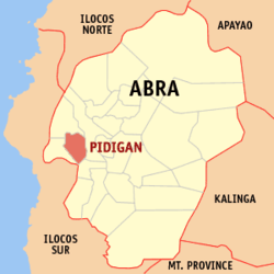
 Map of Abra with Pidigan highlighted | |
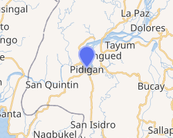
OpenStreetMap 
| |
.svg.png) Pidigan Location within the Philippines | |
| Coordinates: 17°34′N 120°35′E | |
| Country | |
| Region | Cordillera Administrative Region (CAR) |
| Province | Abra |
| District | Lone District |
| Barangays | 15 (see Barangays) |
| Government | |
| • Type | Sangguniang Bayan |
| • Mayor | Joseph Domino A. Valera |
| • Vice Mayor | Arnulfo M. Bisares |
| • Congressman | Joseph Santo Niño B. Bernos |
| • Electorate | 9,266 voters (2019) |
| Area | |
| • Total | 49.15 km2 (18.98 sq mi) |
| Population (2015 census)[3] | |
| • Total | 12,185 |
| • Density | 250/km2 (640/sq mi) |
| • Households | 2,600 |
| Economy | |
| • Income class | 5th municipal income class |
| • Poverty incidence | 14.84% (2015)[4] |
| • Revenue (₱) | 56,412,850.64 (2016) |
| Time zone | UTC+8 (PST) |
| ZIP code | 2806 |
| PSGC | |
| IDD : area code | +63 (0)74 |
| Climate type | tropical rainforest climate |
| Native languages | Itneg language Ilocano Tagalog |
Geography
Pidigan is located at 17°34′N 120°35′E.
According to the Philippine Statistics Authority, the municipality has a land area of 49.15 square kilometres (18.98 sq mi) [2] constituting 1.18% of the 4,165.25-square-kilometre- (1,608.21 sq mi) total area of Abra.
Barangays
Pidigan is politically subdivided into 15 barangays.[5]
| PSGC | Barangay | Population | ±% p.a. | |||
|---|---|---|---|---|---|---|
| 2015[3] | 2010[6] | |||||
| 140118001 | Alinaya | 7.6% | 920 | 996 | −1.50% | |
| 140118002 | Arab | 3.9% | 470 | 458 | 0.49% | |
| 140118004 | Garreta | 5.3% | 649 | 582 | 2.10% | |
| 140118005 | Immuli | 5.0% | 614 | 557 | 1.87% | |
| 140118007 | Laskig | 4.7% | 568 | 484 | 3.09% | |
| 140118009 | Monggoc | 9.7% | 1,182 | 1,101 | 1.36% | |
| 140118008 | Naguirayan | 5.4% | 652 | 698 | −1.29% | |
| 140118010 | Pamutic | 5.2% | 637 | 566 | 2.28% | |
| 140118011 | Pangtud | 11.3% | 1,372 | 1,070 | 4.85% | |
| 140118012 | Poblacion East | 13.3% | 1,623 | 1,603 | 0.24% | |
| 140118013 | Poblacion West | 10.3% | 1,259 | 1,228 | 0.48% | |
| 140118014 | San Diego | 4.2% | 513 | 442 | 2.88% | |
| 140118016 | Sulbec | 5.6% | 682 | 675 | 0.20% | |
| 140118018 | Suyo (Malidong) | 5.4% | 664 | 625 | 1.16% | |
| 140118019 | Yuyeng | 3.1% | 380 | 443 | −2.88% | |
| Total | 12,185 | 11,528 | 1.06% | |||
Climate
| Climate data for Pidigan, Abra | |||||||||||||
|---|---|---|---|---|---|---|---|---|---|---|---|---|---|
| Month | Jan | Feb | Mar | Apr | May | Jun | Jul | Aug | Sep | Oct | Nov | Dec | Year |
| Average high °C (°F) | 29 (84) |
31 (88) |
32 (90) |
34 (93) |
32 (90) |
31 (88) |
30 (86) |
30 (86) |
30 (86) |
30 (86) |
30 (86) |
29 (84) |
31 (87) |
| Average low °C (°F) | 18 (64) |
19 (66) |
20 (68) |
23 (73) |
24 (75) |
24 (75) |
24 (75) |
24 (75) |
23 (73) |
22 (72) |
21 (70) |
19 (66) |
22 (71) |
| Average precipitation mm (inches) | 9 (0.4) |
11 (0.4) |
13 (0.5) |
23 (0.9) |
92 (3.6) |
122 (4.8) |
153 (6.0) |
137 (5.4) |
139 (5.5) |
141 (5.6) |
42 (1.7) |
14 (0.6) |
896 (35.4) |
| Average rainy days | 4.6 | 4.0 | 6.2 | 9.1 | 19.5 | 23.2 | 24.0 | 22.5 | 21.5 | 15.2 | 10.5 | 6.0 | 166.3 |
| Source: Meteoblue [7] | |||||||||||||
Demographics
| Year | Pop. | ±% p.a. |
|---|---|---|
| 1903 | 2,639 | — |
| 1918 | 3,864 | +2.57% |
| 1939 | 3,994 | +0.16% |
| 1948 | 3,473 | −1.54% |
| 1960 | 5,414 | +3.77% |
| 1970 | 6,605 | +2.01% |
| 1975 | 6,897 | +0.87% |
| 1980 | 7,162 | +0.76% |
| 1990 | 8,807 | +2.09% |
| 1995 | 9,098 | +0.61% |
| 2000 | 10,183 | +2.44% |
| 2007 | 11,280 | +1.42% |
| 2010 | 11,528 | +0.79% |
| 2015 | 12,185 | +1.06% |
| Source: Philippine Statistics Authority[3][6][8][9] | ||
In the 2015 census, Pidigan had a population of 12,185.[3] The population density was 250 inhabitants per square kilometre (650/sq mi).
List of Cultural Properties of Pidigan
| Cultural Property wmph identifier |
Site name | Description | Province | City/municipality | Address | Coordinates | Image |
|---|---|---|---|---|---|---|---|
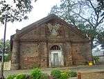
| Pidigan Church | Immaculate Conception Church | Abra | Pidigan | Corner Santiago McKinley St. | 17.570712°N 120.589175°E |  | |
| St. Mary High School | Abra | Pidigan | 17.570749°N 120.589731°E |  | |||
| Bringas Ancestral House Ruins | The house of former municipal mayor Jeremias Bringas. It was used as a provincial capitol when Pidigan was made the temporary seat of the Provincial Government of Abra in 1945.[10] | Abra | Pidigan | 17.56959°N 120.590578°E | |||
| Paaralan Sentral ng Pidigan/Pidigan Central School | Abra | Pidigan | 17.569531°N 120.590068°E | ||||
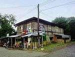
| Figueras Ancestral House | Old house owned by Sinforoso Figueras, the first municipal mayor of Pidigan from 1913 to 1919 and from 1943 to 1945.[10] | Abra | Pidigan | Paredes St. | 17.569944°N 120.590101°E |  |
gollark: So what?
gollark: ?coliru```haskellimport Control.Applicativeimport Data.Listmain = putStr$concat.tails$"just USe pyThon to get the algorithms down and port to Rust for speed"```
gollark: ?coliru```haskellimport Control.Applicativeimport Data.Listmain = putStr$concat.tails$"wico - C is usually premature optimization "```
gollark: ?coliru```haskellimport Control.Applicativeimport Data.Listmain = putStr$concat.tails$"wico be dum"```
gollark: ?coliru```haskellimport Control.Applicativeimport Data.Listimport Data.Monoidimport Control.Monada :: String -> Stringmain = putStr$take 100$concat.tails$"wico be dum"```
References
- "Municipality". Quezon City, Philippines: Department of the Interior and Local Government. Retrieved 31 May 2013.
- "Province: Abra". PSGC Interactive. Quezon City, Philippines: Philippine Statistics Authority. Retrieved 12 November 2016.
- Census of Population (2015). "Cordillera Administrative Region (CAR)". Total Population by Province, City, Municipality and Barangay. PSA. Retrieved 20 June 2016.
- "PSA releases the 2015 Municipal and City Level Poverty Estimates". Quezon City, Philippines. Retrieved 12 October 2019.
- "Municipal: Pidigan". PSGC Interactive. Quezon City, Philippines: Philippine Statistics Authority. Retrieved 8 January 2016.
- Census of Population and Housing (2010). "Cordillera Administrative Region (CAR)". Total Population by Province, City, Municipality and Barangay. NSO. Retrieved 29 June 2016.
- "Pidigan: Average Temperatures and Rainfall". Meteoblue. Retrieved 25 April 2020.
- Censuses of Population (1903–2007). "Cordillera Administrative Region (CAR)". Table 1. Population Enumerated in Various Censuses by Province/Highly Urbanized City: 1903 to 2007. NSO.
- "Province of Abra". Municipality Population Data. Local Water Utilities Administration Research Division. Retrieved 17 December 2016.
- "Municipality of Pidigan, Abra". Department of the Interior and Local Government. Archived from the original on 30 April 2015. Retrieved 30 April 2015.
This article is issued from Wikipedia. The text is licensed under Creative Commons - Attribution - Sharealike. Additional terms may apply for the media files.