Pico do Arieiro
Pico do Arieiro, at 1,818 m (5,965 ft) high, is Madeira Island's third highest peak.[2] Most days, visitors can stand and look down on the clouds. The air is fresh and clear and the sun is very bright. On a clear day it is possible to see the neighbouring island of Porto Santo, 30 miles to the northeast.
| Pico do Arieiro | |
|---|---|
 View of Pico Do Arieiro from the west | |
| Highest point | |
| Elevation | 1,818 m (5,965 ft) [1] |
| Coordinates | 32°44′08″N 16°55′44″W |
| Geography | |
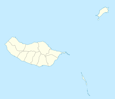 Pico do Arieiro Location of Pico do Arieiro in Madeira | |
| Location | Madeira |
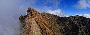
The footpath northwards towards Pico Ruivo is an important tourist attraction, with a daily average of 1000 tourists trekking on it.
There is easy road access to the summit, with a large car park, a restaurant and souvenir shop. In 2011, an Air Defence Radar Station was built at the top of the mountain near the tourist facilities.
References
- Pico do Arieiro at peakbagger.com
- Madeira Geography Archived 2011-07-14 at the Wayback Machine
External links
![]()

Panoramic view from Pico do Arieiro. The footpath from Pico do Arieiro to Pico Ruivo can be seen in the centre of the picture.
This article is issued from Wikipedia. The text is licensed under Creative Commons - Attribution - Sharealike. Additional terms may apply for the media files.