Picacho del Diablo
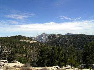
Picacho del Diablo is the highest peak on the Baja California peninsula, measuring 3,096 metres (10,157 ft). It is alternately called Cerro de la Encantada , "Hill of the Enchanted"[2], "Hill of the Bewitched". The peak is located in the Sierra de San Pedro Mártir, part of the Peninsular Ranges, in the Mexican state of Baja California.
| Picacho del Diablo | |
|---|---|
 | |
| Highest point | |
| Elevation | 3,096 m (10,157 ft) |
| Prominence | 2,120 m (6,960 ft) [1] |
| Listing |
|
| Coordinates | 30°59′27″N 115°22′30″W [3] |
| Naming | |
| English translation | Devil's Peak |
| Language of name | Spanish |
| Geography | |
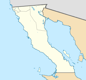
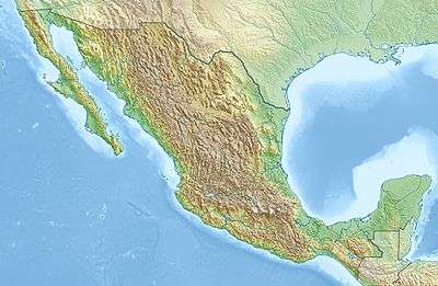
 Picacho del Diablo Location in Mexico  Picacho del Diablo Picacho del Diablo (Mexico) | |
| Location | Sierra de San Pedro Mártir National Park, Mexicali Municipality, Baja California, Mexico |
| Parent range | Sierra San Pedro Mártir |
| Topo map | H11B45 San Rafael |
| Climbing | |
| Easiest route | class 3 scramble |
Climate
The peak has a cold-summer Mediterranean climate (Csc).[4]
| Climate data for Picacho del Diablo Peak 1981-2010 (30.991 -115.375) | |||||||||||||
|---|---|---|---|---|---|---|---|---|---|---|---|---|---|
| Month | Jan | Feb | Mar | Apr | May | Jun | Jul | Aug | Sep | Oct | Nov | Dec | Year |
| Average high °C (°F) | 6.9 (44.4) |
5.3 (41.5) |
5.4 (41.7) |
7.8 (46.0) |
11.2 (52.2) |
16.1 (61.0) |
19.1 (66.4) |
18.9 (66.0) |
16.9 (62.4) |
12.8 (55.0) |
9.1 (48.4) |
7.2 (45.0) |
11.4 (52.5) |
| Daily mean °C (°F) | 2.6 (36.7) |
1.3 (34.3) |
0.9 (33.6) |
2.7 (36.9) |
5.6 (42.1) |
9.8 (49.6) |
13.0 (55.4) |
13.0 (55.4) |
11.2 (52.2) |
7.8 (46.0) |
4.4 (39.9) |
2.9 (37.2) |
6.3 (43.3) |
| Average low °C (°F) | −1.7 (28.9) |
−2.8 (27.0) |
−3.6 (25.5) |
−2.4 (27.7) |
0.1 (32.2) |
3.5 (38.3) |
7.0 (44.6) |
7.2 (45.0) |
5.5 (41.9) |
2.8 (37.0) |
−0.2 (31.6) |
−1.5 (29.3) |
1.2 (34.1) |
| Average precipitation mm (inches) | 151 (5.9) |
140 (5.5) |
176 (6.9) |
12 (0.5) |
7 (0.3) |
2 (0.1) |
44 (1.7) |
52 (2.0) |
36 (1.4) |
13 (0.5) |
50 (2.0) |
111 (4.4) |
794 (31.2) |
| Source: http://www.climatewna.com/ | |||||||||||||
gollark: imagine not being able to summon money from the v͎͜͝o̵̡͝i̧̢͙d̡͜͠
gollark: But if it causes bad things, that would be bad, so you should do it.
gollark: But seriously, why do it if it causes bad things?
gollark: Time to initiate Contingency P-485.
gollark: Oh dear, I have become somewhat predictable.
See also
- List of mountains in Mexico
- Mountain peaks of North America
- List of Ultras of Mexico
References
- "Picacho del Diablo". Peakbagger.com. Retrieved 2008-02-21.
- "DPS Peaks List" (PDF). Sierra Club, Angeles Chapter. April 2003. Retrieved February 3, 2013.
- "Mexico Ultras". Peaklist.org. Retrieved 2012-10-22.
- "ClimateNA_Map". www.climatewna.com. Retrieved 2019-05-18.
This article is issued from Wikipedia. The text is licensed under Creative Commons - Attribution - Sharealike. Additional terms may apply for the media files.