Phayakkhaphum Phisai District
Phayakkhaphum Phisai District (Thai: พยัคฆภูมิพิสัย, pronounced [pʰā.ják.kʰā.pʰūːm pʰí.sǎj]) is a district (amphoe) of Maha Sarakham Province, northeastern Thailand.
Phayakkhaphum Phisai พยัคฆภูมิพิสัย | |
|---|---|
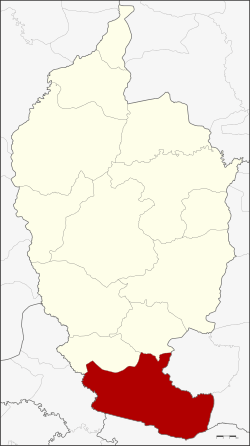 District location in Maha Sarakham Province | |
| Coordinates: 15°30′59″N 103°11′37″E | |
| Country | Thailand |
| Province | Maha Sarakham |
| Area | |
| • Total | 409.783 km2 (158.218 sq mi) |
| Population (2008) | |
| • Total | 88,124 |
| • Density | 214.5/km2 (556/sq mi) |
| Time zone | UTC+7 (ICT) |
| Postal code | 44110 |
| Geocode | 4408 |
Geography
Neighboring districts are (from the north clockwise): Yang Sisurat and Na Dun of Maha Sarakham Province; Pathum Rat, and Kaset Wisai of Roi Et Province; Chumphon Buri of Surin Province; and Phutthaisong of Buriram Province.
Administration
The district is divided into 14 sub-districts (tambons), which are further subdivided into 227 villages (mubans). Phayakkhaphum Phisai is a sub-district municipality (thesaban tambon) which covers parts of tambons Palan and Lan Sakae. There are a further 14 tambon administrative organizations (TAO).
| No. | Name | Thai | Villages | Pop.[1] |
|---|---|---|---|---|
| 1. | Palan | ปะหลาน | 16 | 11,323 |
| 2. | Kam Pu | ก้ามปู | 17 | 6,772 |
| 3. | Wiang Sa-at | เวียงสะอาด | 21 | 6,030 |
| 4. | Mek Dam | เม็กดำ | 22 | 9,690 |
| 5. | Na Si Nuan | นาสีนวล | 14 | 5,939 |
| 9. | Rat Charoen | ราษฎร์เจริญ | 14 | 5,125 |
| 10. | Nong Bua Kaeo | หนองบัวแก้ว | 16 | 6,145 |
| 12. | Mueang Tao | เมืองเตา | 26 | 7,922 |
| 15. | Lan Sakae | ลานสะแก | 19 | 6,881 |
| 16. | Wiang Chai | เวียงชัย | 14 | 3,934 |
| 17. | Nong Bua | หนองบัว | 13 | 5,852 |
| 18. | Rat Phatthana | ราษฎร์พัฒนา | 14 | 3,852 |
| 19. | Mueang Suea | เมืองเสือ | 11 | 4,507 |
| 20. | Phan Aen | ภารแอ่น | 10 | 4,152 |
Missing numbers are tambons which now form Yang Sisurat District.
References
- "Population statistics 2008". Department of Provincial Administration. Archived from the original on 2009-08-20.
External links
- amphoe.com (Thai)