Petarwar
Petarwar (also spelled Petarbar, Peterbar, Peterwar) is a village in Petarwar CD Block in Bermo subdivision of Bokaro district in the Indian state of Jharkhand.
Petarwar | |
|---|---|
Village | |
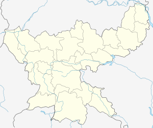
 Petarwar Location in Jharkhand, India  Petarwar Petarwar (India) | |
| Coordinates: 23.621389°N 85.851333°E | |
| Country | |
| State | Jharkhand |
| District | Bokaro |
| Population (2011) | |
| • Total | 5,060 |
| Languages | |
| • Official | Hindi |
| Time zone | UTC+5:30 (IST) |
| PIN | 829121 (Petarwar) |
| Telephone/ STD code | 06549 |
Police station
Petarwar police station is located at Petarwar.[1]
Demographics
As per the 2011 Census of India Petarbar had a total population of 5,060, of which 2,677 (53%) were males and 2,383 (47%) were females. Population below 6 years was 615. The total number of literates in Petarbar was 3,351 (87.85% of the population over 6 years).[3]
Transport
NH 320 passes through Petarwar. A road connects Petarawar to Tenughat Dam and Gomia.[4]
gollark: It'll finally be able to negotiate better trade deals with aliens!
gollark: One day the UK will just vote to leave Earth, and try and launch itself into orbit to stop immigration or somehow negotiate better trade deals.
gollark: The philosophy memes subreddit is wonderful.
gollark: So it's the broken version.
gollark: I haven't updated to the latest one because, like I said, my GPU (or that PCIe slot or something, who knows) died.
References
- "Jharkhand Police Official Website". Contact Bokaro Police. Jharkhand Police. Archived from the original on 14 February 2014. Retrieved 6 October 2017.
- "2011 District Census Handbook Bokaro, Series 21, Part XII B" (PDF). Map on Page 3. Directorate of Census Operations, Jharkhand. Retrieved 6 October 2017.
- "2011 Census C.D. Block Wise Primary Census Abstract Data(PCA)". Jharkhand – District-wise CD Blocks. Registrar General and Census Commissioner, India. Retrieved 6 October 2017.
- Google maps
This article is issued from Wikipedia. The text is licensed under Creative Commons - Attribution - Sharealike. Additional terms may apply for the media files.