Peralada
Peralada (Catalan pronunciation: [pəɾəˈlaðə]) is a village in the province of Girona, Catalonia, Spain. It was the home of the Frankish Counts of Peralada who controlled this portion of the Marca Hispanica before becoming part of the lands held by the Count of Barcelona.
Peralada | |
|---|---|
 Flag  Coat of arms | |
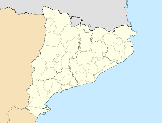
 Peralada Location of Peralada in Catalonia | |
| Coordinates: 42°18′32″N 3°0′39″E | |
| Country | Spain |
| Region | Catalonia |
| Province | Girona |
| Comarca | Alt Empordà |
| Government | |
| • Mayor | Pere Torrent Martin (2015)[1] |
| Area | |
| • Total | 43.6 km2 (16.8 sq mi) |
| Elevation | 100 m (300 ft) |
| Population (2018)[3] | |
| • Total | 1,868 |
| • Density | 43/km2 (110/sq mi) |
| Demonym(s) | Peraladenc |
| Website | peralada |
Figueres is 6.5 km to the west, Roses 13.6 km to the south east. The N-260 to the south connects Figueres with Portbou and the French border.
The local economy is based on tourism and winemaking.
Since 1987 a festival of music has been held in Peralada.
Main sights
- The castle, restored in the 19th century in French style.
- Parish church of St. Martin (18th century). Of the previous medieval edifice, the bell tower has survived.
- Convent of St. Dominic (11th century). The church interior has capitals with biblical, flower and geometrical themes.
- Church of Santa Eulàlia (15th century)
- Convent del Carme (1293), with a Gothic cloister from the 14th century
gollark: CC is less hassle especially with crafting.
gollark: Why do they need Unicode support that much?
gollark: OC's crafting recipes are the epitome of evil.
gollark: I'm not sure either way is *better*, but I prefer CC's simplicity.
gollark: CC is also lacking Unicode support.
References
- "Ajuntament de Peralada". Generalitat of Catalonia. Retrieved 2015-11-13.
- "El municipi en xifres: Peralada". Statistical Institute of Catalonia. Retrieved 2015-11-23.
- Municipal Register of Spain 2018. National Statistics Institute.
- Bolòs, Jordi; Víctor Hurtado (1999). Atles dels comtats d'Empúries i Peralada (780-991). Barcelona: Rafael Dalmau. 84-232-0604-1.
- Comte, Albert (2001). La Canònica gironina i la geografia urbana de Castelló d’Empúries en la Baixa Edat Mitjana. Figueres: Geografia.
This article is issued from Wikipedia. The text is licensed under Creative Commons - Attribution - Sharealike. Additional terms may apply for the media files.