Pentakota
Pentakota is a village in Payakaraopeta mandal of Visakhapatnam district, Andhra Pradesh, India.
Pentakota Surname of Gavara Community | |
|---|---|
village | |
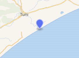
.svg.png) Pentakota Location in Andhra Pradesh, India  Pentakota Pentakota (India) | |
| Coordinates: 17.3000°N 82.6167°E | |
| Country | |
| State | Andhra Pradesh |
| District | Visakhapatnam |
| Elevation | 0 m (0 ft) |
| Languages | |
| • Official | Telugu |
| Time zone | UTC+5:30 (IST) |
| Climate | hot (Köppen) |
| |
| Location | Payakaraopeta mandal, India |
|---|---|
| Coordinates | 17.296011°N 82.618250°E |
| Year first constructed | 1957 |
| Construction | masonry tower |
| Tower shape | square tower with balcony and lantern |
| Markings / pattern | white and black bands tower, red lantern dome |
| Tower height | 18 metres (59 ft) |
| Focal height | 18 metres (59 ft) |
| Characteristic | Fl W 15s. |
| Admiralty number | F0966 |
| NGA number | 27016 |
| ARLHS number | IND-051[1] |
There is an old lighthouse in the village.[2] It is 18 metres (59 ft) high and was built in 1957. It has a range of 21 nautical miles (39 km; 24 mi).
Geography
Pentakpta has an average elevation of 0 metres (0 ft).
gollark: The last one would also be obtainable via drama, then.
gollark: Finally, one would be obtainable by demanding one from God-Emperor TJ09.
gollark: One would be put in the *AP* at random.
gollark: One in the cave, one by raffle, one by posting trades automatically and randomly picking offers, one via a secret link, one via breeding random dragons (they'd occasionally produce a new CB sinnerscale)...
gollark: They would each be given out in annoying ways.
References
- Rowlett, Russ. "Lighthouses of India: West Bengal, Orissa, and Andhra Pradesh". The Lighthouse Directory. University of North Carolina at Chapel Hill. Retrieved 8 February 2016.
- Pentakota Lighthouse at the Directorate General of Lighthouses and Lightships Archived 2011-07-21 at the Wayback Machine
This article is issued from Wikipedia. The text is licensed under Creative Commons - Attribution - Sharealike. Additional terms may apply for the media files.