Penamacor
Penamacor (Portuguese pronunciation: [pɨnɐmɐˈkoɾ] (![]()
Penamacor | |
|---|---|
 Flag  Coat of arms | |
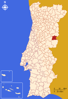 | |
| Coordinates: 40.1683°N 7.1672°W | |
| Country | |
| Region | Centro |
| Intermunic. comm. | Beira Baixa |
| District | Castelo Branco |
| Parishes | 9 |
| Government | |
| • President | Domingos Torrão (PS) |
| Area | |
| • Total | 563.71 km2 (217.65 sq mi) |
| Population (2011) | |
| • Total | 5,682 |
| • Density | 10/km2 (26/sq mi) |
| Time zone | UTC±00:00 (WET) |
| • Summer (DST) | UTC+01:00 (WEST) |
| Local holiday | Easter Monday date varies |
| Website | http://www.cm-penamacor.pt |
The mayor is António Luís Beites Soares.[3] The municipal holiday is Easter Monday.
Parishes
Administratively, the municipality is divided into 9 civil parishes (freguesias):[4]
- Aldeia do Bispo, Águas e Aldeia de João Pires
- Aranhas
- Benquerença
- Meimão
- Meimoa
- Pedrógão de São Pedro e Bemposta
- Penamacor
- Salvador
- Vale da Senhora da Póvoa
gollark: When I tried to run a new krist node, it broke horribly and I eventually got it to not error (still didn't work) but there's a bug with the block values on new nodes.
gollark: As in, ones without a preexisting database.
gollark: Well, new ones, at least.
gollark: Krist nodes are nightmarish to run.
gollark: Just "".
References
- Instituto Nacional de Estatística
- "Áreas das freguesias, concelhos, distritos e país". Archived from the original on 2018-11-05. Retrieved 2018-11-05.
- Penamacor Boletim Informative No 36 Julho 2014
- Diário da República. "Law nr. 11-A/2013, page 552 92" (pdf) (in Portuguese). Retrieved 29 July 2014.
External links
| Authority control |
|
|---|
This article is issued from Wikipedia. The text is licensed under Creative Commons - Attribution - Sharealike. Additional terms may apply for the media files.