Pedaparimi
Pedaparimi is a village in Guntur district of the Indian state of Andhra Pradesh. It is located in Thullur mandal of Guntur revenue division.[1][2] It lies adjacent to state capital Amaravati.[3]
Pedaparimi | |
|---|---|
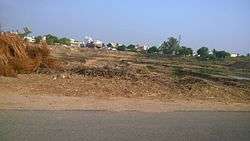 A view of village from Guntur road | |
.svg.png) Pedaparimi Location in Andhra Pradesh, India  Pedaparimi Pedaparimi (India) | |
| Coordinates: 16.27497°N 80.27182°E | |
| Country | India |
| State | Andhra Pradesh |
| District | Guntur |
| Mandal | Thullur |
| Area | |
| • Total | 26.36 km2 (10.18 sq mi) |
| Population (2011)[1] | |
| • Total | 6,887 |
| • Density | 260/km2 (680/sq mi) |
| Languages | |
| • Official | Telugu |
| Time zone | UTC+05:30 (IST) |
| Vehicle registration | AP-07 |
Demographics
As of 2011 Census of India, Pedaparmi had a population of 6,887. The total population constitutes 3,388 males and 3,499 females with a sex ratio of 1033 females per 1000 males. 646 children are in the age group of 0–6 years, a ratio of 1019 girls per 1000 boys. The average literacy rate stands at 66.16% with 4,129 literates, slightly lower than the state average of 67.41%.[1][4]
gollark: It means to make local.
gollark: Assuming these "military police" had higher standards than regular police now, would that still be the case if you scaled that system up to match all the ones they're replacing?
gollark: Members of parliament?
gollark: Whatever the cause actually is, I'm not sure there really is a hugely consistent one.
gollark: Destroying random people's stuff is unlikely to make anyone sympathetic to the cause.
See also
References
- "District Census Handbook - Guntur" (PDF). Census of India. p. 14,258. Retrieved 28 December 2015.
- "District Level Mandal wise List of Villages in Andhra Pradesh" (PDF). Chief Commissioner of Land Administration. National Informatics Centre. p. 11. Archived from the original (PDF) on 10 December 2014. Retrieved 12 January 2016.
- kumar, b tharun (1 September 2015). "Groundwater level rises in capital region villages". Deccan Chronicle. Retrieved 2 December 2019.
- "Literacy of AP (Census 2011)" (PDF). Official Portal of Andhra Pradesh Government. p. 43. Archived from the original (PDF) on 14 July 2014. Retrieved 5 September 2014.
External links
This article is issued from Wikipedia. The text is licensed under Creative Commons - Attribution - Sharealike. Additional terms may apply for the media files.