Patnitop
Patnitop or Patni Top is a hilltop tourist location in Udhampur district in the Jammu and Kashmir union territory of India, on the Jammu-Srinagar National Highway (which is part of National Highway 44, formerly 1A), 112 km (70 mi) from Jammu on the way from Udhampur to Srinagar. Situated on a plateau in the Shivalik belt of the Himalayas, Patnitop sits at an altitude of 2,024 m (6,640 ft). The river Chenab flows in close proximity to this location.[1]
Patnitop | |
|---|---|
Hill Station | |
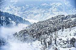 Patnitop in Winter | |
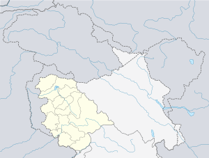 Patnitop Location in Jammu and Kashmir  Patnitop Patnitop (India) | |
| Coordinates: 33°5′25″N 75°19′35″E | |
| Country | |
| State | Jammu and Kashmir |
| District | Udhampur |
| Elevation | 2,024 m (6,640 ft) |
| Time zone | UTC+5:30 (IST) |
| PIN | 182142 |
| Website | patnitop |
Dr. Syama Prasad Mookerjee tunnel
Snowfall and avalanche in winter at Patnitop used to obstruct the Jammu-Srinagar National Highway a few times every winter and causes long queues of vehicles, sometimes for days. These problems were mitigated by the opening of the Dr. Syama Prasad Mookerjee Tunnel. At 9.2 km (6 mi), it is India's longest road tunnel. It starts from about 2 km (1 mi) from Chenani town south of Patnitop to Nashri village north of Patnitop, reducing the distance from Jammu to Srinagar by 31 km (19 mi) and bypassing Patnitop.[2]
Gallery
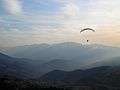 Paragliding at Patnitop
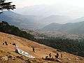 Dawariyai take off area at Patnitop
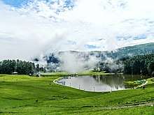 Sanasar Lake
 Patnitop Mountains
References
- Silas, Sandeep (2005). "17. Patnitop". Discover India by Rail. Sterling Publishers. p. 47. ISBN 81-207-2939-0.
- "Chenani Nashri Tunnel Completes 2 km Excavation". ConstructionWeekOnline.in.