Passani
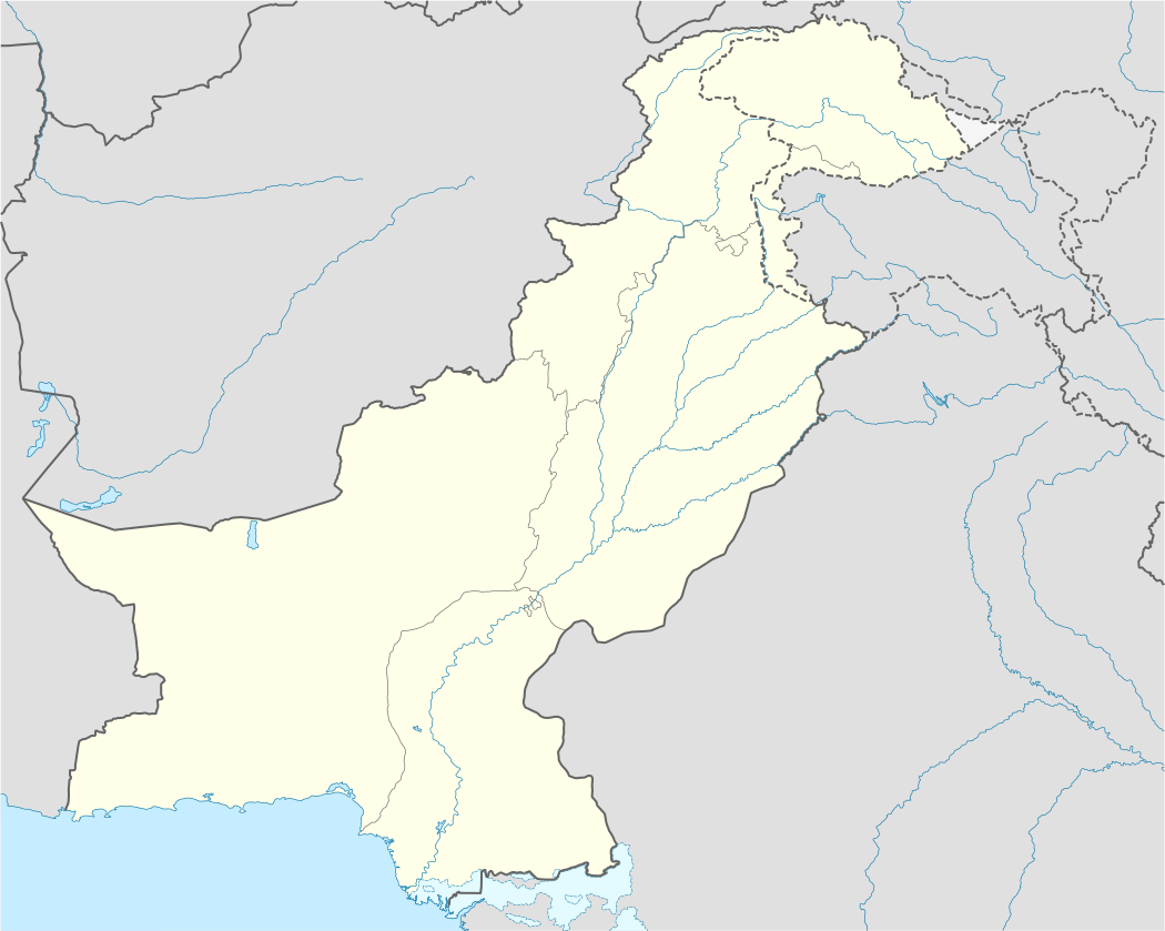
Passani (Urdu: پاسنى) is located 33°76'4N 71°59'1E at south of Peshawar, Khyber Pakhtunkhwa, Pakistan.
Passani پاسنى | |
|---|---|
 Passani | |
| Coordinates: 33°45′48.61″N 71°35′30.81″E | |
| Country | |
| Province | Khyber Pakhtunkhwa |
| District | Peshawar District |
| Tehsil | Peshawar Tehsil |
| Union council | Maryam Zai |
| Area | |
| • Total | 3.0 km2 (1.2 sq mi) |
| Population (1998) | |
| • Total | 3,000 |
| • Estimate (2015) | 6,000 |
| Time zone | UTC+5 (PST) |
| Calling code | 091 |
Passani is situated 33 km south of Peshawar, the last village of Peshawar District.
Education
The village have three primary school one for boys and two for girls, and a middle school for boys also a high school for girls. The literacy rate is 80% for men and 50% for women. The main profession of the people is farming, gov't job and business.
PASSANI IS BUSINESS HUB FOR SURROUNDING AREA OF ADEZAI,SHERKERA, KANDAO,HASANKHEL,JANAKOD,BORA, PASTAWONE,ARATBABA,YARANKHEL,MIAGHADI
Neighbourhoods of Peshawar | ||
|---|---|---|
Administrations: Peshawar Division and Peshawar District | ||
| Cities |
|  |
| Tehsils |
| |
| Towns & councils |
| |
Website: Peshawar District at NRB | ||
gollark: Please read the "update" at the end?
gollark: Okay, explain.
gollark: https://status.osmarks.net/
gollark: No, corporate policy forbids this.
gollark: What? No, we optimize to arbitrary depth in all parallel universes and timelines simultaneously.
This article is issued from Wikipedia. The text is licensed under Creative Commons - Attribution - Sharealike. Additional terms may apply for the media files.