Parish of Hume (Mouramba County)
Hume Parish in Mouramba County,[2] central New South Wales is a cadasteral parish of Australia.[3]
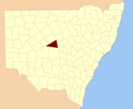
Mouramba County
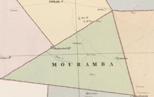
Map of Mouramba County (New South Wales) in 1886.[1]
Geography
The topography of the parish is generally hilly and mostly covered with forest.
The parish is on the Kidman Way where it crosses the Sandy Creek (Central West, New South Wales), a tributary of the Bogan River and the nearest town is Nymagee, New South Wales.
The parish is within Cobar Shire and the main economy of the area is based on agriculture.
gollark: Wow, I love it when my python program unfathomably fails with errors in C?
gollark: Yes, well, pulseaudio is what I have installed due to firefox.
gollark: Muahahha, I am going to implement PUSH TO TALK using PULSEAUDIO HAX and PYTHON.
gollark: It's one of those things which is too vaguely defined to be *false* exactly, but rather stupid.
gollark: It doesn't seem very meaningful.
References
- John Sands, Atlas of Australia 1886.
- "Mouramba County". Geographical Names Register (GNR) of NSW. Geographical Names Board of New South Wales.

- Map of the County of Mouramba, New South Wales. Department of Lands 1916.
This article is issued from Wikipedia. The text is licensed under Creative Commons - Attribution - Sharealike. Additional terms may apply for the media files.