Parish of Hebden
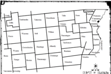
Hebden is a Parish of Ularara County in north west New South Wales.[1]
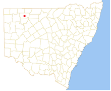
Located at 29.725556°S 143.983056°E 10km west of Wanaaring, New South Wales the main economic activity of the parish is agriculture. The climate is semi-arid, featuring low rainfall, very hot summer temperatures and cool nights in winter.
The Parish is on Possum Creek, a tributary of the Paroo River.
History
Hebden Parish is on the traditional lands of the Paaruntyi people and The Burke and Wills expedition were the first Europeans to the area.
Climate
The climate is semi-arid, featuring low rainfall, very hot summer temperatures and cool nights in winter. The parish has a Köppen climate classification of BWh (Hot desert)[2]. A minimum temperature of -3.9 oC was recorded in July 1997.[3]
| Wanaaring | ||||||||||||||||||||||||||||||||||||||||||||||||||||||||||||
|---|---|---|---|---|---|---|---|---|---|---|---|---|---|---|---|---|---|---|---|---|---|---|---|---|---|---|---|---|---|---|---|---|---|---|---|---|---|---|---|---|---|---|---|---|---|---|---|---|---|---|---|---|---|---|---|---|---|---|---|---|
| Climate chart (explanation) | ||||||||||||||||||||||||||||||||||||||||||||||||||||||||||||
| ||||||||||||||||||||||||||||||||||||||||||||||||||||||||||||
| ||||||||||||||||||||||||||||||||||||||||||||||||||||||||||||
References
- "Ularara". Geographical Names Register (GNR) of NSW. Geographical Names Board of New South Wales. Retrieved 11 August 2013.

- Peel, M. C.; Finlayson, B. L.; McMahon, T. A. (2007). "Updated world map of the Köppen–Geiger climate classification". Hydrol. Earth Syst. Sci. 11: 1633–1644. doi:10.5194/hess-11-1633-2007. ISSN 1027-5606. (direct: Final Revised Paper)
- http://www.bom.gov.au/climate/averages/tables/cw_048079_All.shtml