Parish of Boorla
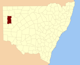
Boorla located at 30.968333°S 141.859167°E is a remote civil parish of Mootwingee County in far North West New South Wales.[1]
Geography
The Geography, of the Parish is mostly the flat, arid landscape of the Channel Country. The parish has a Köppen climate classification of BWh (Hot desert)[2]. The nearest town is Tibooburra to the north and Whitecliffs to the east.
The Parish is on the traditional lands of the Bandjigali peoples[3] Aboriginal peoples.[4]
Charles Sturt passed through the area during 1845,[5] In 1861 the Burke and Will's expedition passed to the east.[6]
gollark: Yes. I'm aware some people didn't, but it would be significantly worse if they did more of them.
gollark: They probably *won't* be if the perception is that they will just do it arbitrarily and repeatedly for ages and it just slows down things at best.
gollark: Anyway, people have seemingly been mostly willing to engage in obeying lockdown when there was a clearish danger and it seemed like a temporary onetime thing.
gollark: Congratulations, you handed power over to the test designers?
gollark: Also, the more times they end up doing them the less willing people will be to actually abide by the rules.
References
- "Mootwingee County". Geographical Names Register (GNR) of NSW. Geographical Names Board of New South Wales.

- Peel, M. C.; Finlayson, B. L.; McMahon, T. A. (2007). "Updated world map of the Köppen–Geiger climate classification". Hydrol. Earth Syst. Sci. 11: 1633–1644. doi:10.5194/hess-11-1633-2007. ISSN 1027-5606. (direct: Final Revised Paper)
- Tindale, Norman Barnett (1974) Aboriginal Tribes of Australia: Their Terrain, Environmental Controls, Distribution, Limits, and Proper Names. Australian National University Press. p196.
- David R Horton (creator), Aboriginal Studies Press, AIATSIS, and Auslig/Sinclair, Knight, Merz, 1996.
- Sturt's Central Australian Expedition Archived 1 March 2018 at the Wayback Machine.
- The Burke and Wills Expedition Archived 1 March 2018 at the Wayback Machine.
This article is issued from Wikipedia. The text is licensed under Creative Commons - Attribution - Sharealike. Additional terms may apply for the media files.