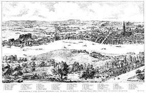
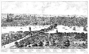
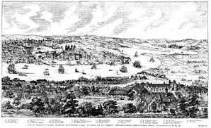
Panorama of London
The city of London has long been a subject for panoramas by artists, mapmakers, and topographers. Many of their works have this as their title.
Overview
The earliest topographical drawings preceded maps according to modern definition, although they were mainly based on surveys or multiple drawings reduced to a (fairly) consistent perspective, as it is clearly impossible for them to have been produced from any single real viewpoint, unlike modern photographic panoramas. Wenceslaus Hollar's 1647 Long View of London from Bankside is an exception. Projected from a single viewpoint it resembles the perspective of a modern panoramic photograph.
Gallery
Amongst the earliest known is that by Flemish topographer Anton van den Wyngaerde, produced in 1543 and published by London Topographical Society in 1881 with key added on bottom as reproduced here:[1]
Others include Van Visscher's of 1616:
Wenceslaus Hollar's Long View of London from Bankside of 1647:
Another by Hollar, 1666
Many modern panoramic photographs of London exist, from many different viewpoints:
References
- "Facsimile of Panorama of London in 1543: 1881, Antony Van Den Wyngaerde". Museum of London Prints. Retrieved 18 December 2018.
External links
![]()


.jpg)
_2.jpg)


