Pandarikulam
Pandarikulam (Vavuniya-03 or official designation 214E[1]), (Tamil: பண்டாரிகுளம், romanized: Paṇṭārikuḷam; Sinhala: පණ්ඩාරිකුලම්, romanized: Paṇḍārikulam) is a suburb of Vavuniya in northern Sri Lanka.[2]
Pandarikulam பண்டாரிகுளம் පණ්ඩාරිකුලම් | |
|---|---|
Suburb | |
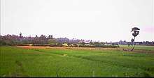
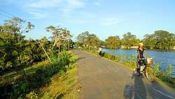 Road Connects Vavuniya Town & Pandarikulam | |
 Pandarikulam 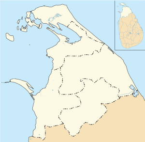 Pandarikulam  Pandarikulam | |
| Coordinates: 8°45′25″N 80°28′30″E | |
| Country | Sri Lanka |
| Province | Northern Province, Sri Lanka |
| District | Vavuniya |
| Urban Council | Vavuniya Urban Council |
| Named for | Pandara Wanniyan |
| Government | |
| • Body | Grama Niladhari |
| Elevation | 104 m (341 ft) |
| Population | |
| • Total | 1,800 |
| Time zone | UTC+5:30 |
| Postal Code | 43000 |
| Area code(s) | 024 |
The village was previously known as Karunkaliyadithoddam (Tamil: கருங்காலியடித்தோட்டம், romanized: Karuṅkāliyaṭittōṭṭam, lit. 'Ebony Garden') because of the Ebony trees in the area.[3][4]
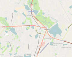
Pandarikulam is one of a number of villages that surrounded Vanuniya which have been annexed by the town as it expanded.[5] Pandarikulam is located 1 km (0.62 mi) away from the centre of Vavuniya.[6]
Location
Pandarikulam is located 1 km (0.62 mi) away from Vanuniya. It is bordered to the north by Kurumankadu, to the east by Vairavarpuliyankula, to the west by Ukkulankulam, and to the south by Pandarikulam South.
History
After the death of King Pandara Vanniyan in 1803, the place fell under the Kingdom of Kandy, until its eventual absorption by the British Empire as a protectorate following the Kandyan Convention of 1815.[7][8]
Historical Place
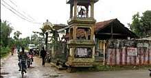
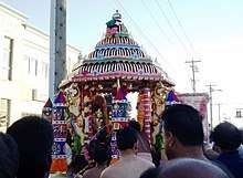
Pandarikulam Muthumari Amman Kovil is an Hindu Temple in Pandarikulam. This temple was built in 1522AD. This is the Largest & Biggest Hindu Temple in Vavuniya District.[9]
Education
- Vipulanantha College[10]
- Maths Centre
- Education Development Institute (EDI)
- Lincoln English Academy
- Colombus Best Institute (CBI)
Transport
- Vavuniya Railway Station, located 100 m (330 ft) from Pandarikulam.
- Vavuniya Airport 1 km (0.62 mi)
- Vavuniya Bus Stand 1 km (0.62 mi)
References
- "214E". www.vavuniya.dist.gov.lk. Retrieved 17 June 2019.
- The traditional homeland of the Tamils. Kanal Publications. 1996. p. 376. ISBN 9789559424000.
- "Maps, Weather, and Airports for Pandarikulam, Sri Lanka". Fallingrain.com. Retrieved 8 April 2019.
- "Pandarikulam, Sri Lanka - Geographical Names, map, geographic coordinates". Geographic.org. Retrieved 8 April 2019.
- Geographia Polonica, Issues 35-39. Polish Scientific Publishers. 1977. p. 160.
- "Satellite map of Sri Lanka : Google™ — share any place, address search; cities, countries, regions". Satellites.pro. Retrieved 8 April 2019.
- "Pandarikulam Road, Vavuniya District". Mapio.net. Retrieved 22 June 2019.
- "Vipulananda college, Pandarikulam, Vavuniya". Mapio.net. Retrieved 22 June 2019.
- "Amman Kovil Road Pandarikulam". Mapio.net. Retrieved 26 June 2019.
- "Vipulananda college, Pandarikulam, Vavuniya". Mapio.net. Retrieved 26 June 2019.