Palmetto, Missouri
Palmetto is an unincorporated community in southeastern Greene County, in the U.S. state of Missouri.[1] The community lies at an elevation of 1437 feet[1] and is located near the headwaters of Turner Creek on the BNSF Railway, approximately two miles northwest of Rogersville. Henderson in western Webster County lies approximately 1.5 miles to the east along Missouri Route D.[2][3]
History
A post office called Palmetto was established in 1890, and remained in operation until 1914.[4] It us unknown why the name Palmetto was applied to this community.[5]
gollark: Mere placebo, then.
gollark: To play the MP3 file, your audio player is *internally doing the same thing* as what the MP3→WAV conversion is doing.
gollark: Wrong.
gollark: I see.
gollark: Are you asking me or them?
References
- U.S. Geological Survey Geographic Names Information System: Palmetto, Missouri
- Ozark, MO, 15 Minute Topographic Quadrangle, USGS, 1943
- Missouri Atlas & Gazetteer, DeLorme, 1998, First edition, p. 52, ISBN 0-89933-224-2
- "Post Offices". Jim Forte Postal History. Retrieved 3 October 2016.
- "Greene County Place Names, 1928–1945 (archived)". The State Historical Society of Missouri. Archived from the original on 24 June 2016. Retrieved 3 October 2016.CS1 maint: BOT: original-url status unknown (link)
Municipalities and communities of Greene County, Missouri, United States | ||
|---|---|---|
| Cities | 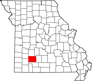 Map of Missouri highlighting Greene County | |
| Townships |
| |
| Unincorporated communities | ||
| Former settlement | ||
| Footnotes | ‡This populated place also has portions in an adjacent county or counties | |
This article is issued from Wikipedia. The text is licensed under Creative Commons - Attribution - Sharealike. Additional terms may apply for the media files.