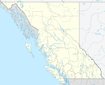
Oyama, British Columbia
Oyama is a neighbourhood and formal ward located within the district municipality of Lake Country, which is located in the Okanagan region in British Columbia, Canada. It is located at the north end of Wood Lake and at the south end of Kalamalka Lake opposite BC Highway 97.[1]
Oyama | |
|---|---|
 Looking across frozen Kalamalka Lake from Kaloya Regional Park | |
| Coordinates: 50°07′00″N 119°22′00″W | |
| Country | Canada |
| Province | British Columbia |
| Region | Okanagan |
| District | Lake Country |
| Population | 985 |
Name origin
Oyama is named after Japanese Field Marshal Ōyama Iwao in 1906 by the first post master Dr. W. H. Irvine.[2][3]:200a
Climate
| Climate data for Oyama | |||||||||||||
|---|---|---|---|---|---|---|---|---|---|---|---|---|---|
| Month | Jan | Feb | Mar | Apr | May | Jun | Jul | Aug | Sep | Oct | Nov | Dec | Year |
| Record high °C (°F) | 16 (61) |
15 (59) |
21 (70) |
27.8 (82.0) |
33 (91) |
36.5 (97.7) |
39 (102) |
37 (99) |
32.5 (90.5) |
27.5 (81.5) |
20 (68) |
13.5 (56.3) |
39 (102) |
| Average high °C (°F) | 0.6 (33.1) |
2.8 (37.0) |
9.6 (49.3) |
14.7 (58.5) |
19.8 (67.6) |
23.3 (73.9) |
26.3 (79.3) |
26.6 (79.9) |
20.4 (68.7) |
12.6 (54.7) |
4.8 (40.6) |
0 (32) |
13.5 (56.2) |
| Daily mean °C (°F) | −1.9 (28.6) |
−0.6 (30.9) |
4.5 (40.1) |
8.9 (48.0) |
13.4 (56.1) |
17.1 (62.8) |
19.4 (66.9) |
19.7 (67.5) |
14.4 (57.9) |
8.2 (46.8) |
2 (36) |
−2.3 (27.9) |
8.6 (47.5) |
| Average low °C (°F) | −4.4 (24.1) |
−3.9 (25.0) |
−0.6 (30.9) |
3.1 (37.6) |
6.9 (44.4) |
10.9 (51.6) |
12.5 (54.5) |
12.8 (55.0) |
8.3 (46.9) |
3.8 (38.8) |
−0.9 (30.4) |
−4.6 (23.7) |
3.7 (38.7) |
| Record low °C (°F) | −25.5 (−13.9) |
−23 (−9) |
−19.4 (−2.9) |
−5 (23) |
−2 (28) |
0.6 (33.1) |
3.9 (39.0) |
3.5 (38.3) |
−2.5 (27.5) |
−16 (3) |
−27.5 (−17.5) |
−26.5 (−15.7) |
−27.5 (−17.5) |
| Average precipitation mm (inches) | 41.1 (1.62) |
32 (1.3) |
32.3 (1.27) |
37.6 (1.48) |
48 (1.9) |
54.1 (2.13) |
50.7 (2.00) |
34.5 (1.36) |
43.2 (1.70) |
36.4 (1.43) |
53.6 (2.11) |
51.9 (2.04) |
515.2 (20.28) |
| Average rainfall mm (inches) | 12.6 (0.50) |
18 (0.7) |
27.7 (1.09) |
37.6 (1.48) |
48 (1.9) |
54.1 (2.13) |
50.7 (2.00) |
34.5 (1.36) |
43.2 (1.70) |
35.9 (1.41) |
36.1 (1.42) |
12.6 (0.50) |
411 (16.2) |
| Average snowfall cm (inches) | 28.5 (11.2) |
14 (5.5) |
4.5 (1.8) |
0 (0) |
0 (0) |
0 (0) |
0 (0) |
0 (0) |
0 (0) |
0.5 (0.2) |
17.5 (6.9) |
39.3 (15.5) |
104.2 (41.0) |
| Source: [4] | |||||||||||||
Education
It is home to Oyama Traditional School, a public elementary school that is part of the School District 23 Central Okanagan, which is based in Kelowna.[5]
gollark: We could just go through all companies in order until we find the one sporeball works at.
gollark: However, hello boi.
gollark: We all know Macron isn't real.
gollark: Highly advanced javascriptoidal forms, wow.
gollark: It says "works without JS", not "no JS".
References
| Wikimedia Commons has media related to Oyama, British Columbia. |
- BC Names entry "Oyama (community)"
- "Oyama". Lake Country Museum.
- Akrigg, G.P.V.; Akrigg, Helen B. (1986), British Columbia Place Names (3rd, 1997 ed.), Vancouver: UBC Press, ISBN 0-7748-0636-2
- "Calculation Information for 1981 to 2010 Canadian Normals Data". Environment Canada. Archived from the original on June 14, 2013. Retrieved July 9, 2013.
- "School Directory". School District 23 Central Okanagan. Retrieved December 5, 2012.
This article is issued from Wikipedia. The text is licensed under Creative Commons - Attribution - Sharealike. Additional terms may apply for the media files.

