Ouangolodougou, Ivory Coast
Ouangolodougou (also known as Wangolodougou) is a town in the far north of Ivory Coast, adjacent to the border with Burkina Faso. It is a sub-prefecture of and the seat of Ouangolodougou Department in Tchologo Region, Savanes District. Ouangolodougou is also a commune.
Ouangolodougou Wangolodougou | |
|---|---|
Town, sub-prefecture, and commune | |
 Ouangolodougou Location in Côte d'Ivoire | |
| Coordinates: 9°58′N 5°9′W | |
| Country | |
| Region | Savanes |
| Region | Tchologo |
| Department | Ouangolodougou |
| Elevation | 303 m (994 ft) |
| Population (2014)[1] | |
| • Total | 74,519 |
| Time zone | UTC+0 (GMT) |
Ouangolodougou is in the sub-Saharan Sahel savanna biogeography region, which is characterised by grasslands with trees.
Transport
The town is served by a station on the Abidjan-Niger Railway.
In 2014, the population of the sub-prefecture of Ouangolodougou was 74,519.[2]
Villages
The 14 villages of the sub-prefecture of Ouangolodougou and their population in 2014 are[2]:
- Bénifesso (763)
- Brahimadougou (4 386)
- Broundougou (2 335)
- Niornigué 1 (2 465)
- Nioronigue 2 (1 947)
- Ouangolodougou (37 991)
- Sokourani (1 086)
- Torla (2 328)
- Torla-Noumozo (188)
- Bakarydougou (2 361)
- Diarratiédougou (1 046)
- Nambingué (12 865)
- Pléouo (2 422)
- Zandanakaha (Gbinzo Ii) (2 336)
gollark: It can output arbitrary syscalls.
gollark: osmarks.net gollarious hypercloud blockchain engineering™ coreutils™ just feed all of `argv` to a GPT-Neo model trained on lots of Linux commands.
gollark: Is "osmarks.net software" a trendy enough name? Maybe it should be "osmarks.net gollarious hypercloud blockchain engineering™ software".
gollark: Anyway, the DreamOS repos should contain *entirely* osmarks.net software.
gollark: ÆÆÆÆÆÆÆÆÆ
References
- "Côte d'Ivoire". geohive.com. Retrieved 14 December 2015.
- "RGPH 2014, Répertoire des localités, Région Tchologo" (PDF). ins.ci. Retrieved 5 August 2019.
Regional seat: Ferkessédougou | ||
| Ferkessédougou Department | 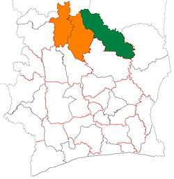 | |
| Kong Department | ||
| Ouangolodougou Department | ||
* also a commune | ||
This article is issued from Wikipedia. The text is licensed under Creative Commons - Attribution - Sharealike. Additional terms may apply for the media files.