Orešje nad Sevnico
Orešje nad Sevnico (pronounced [ɔˈɾeːʃjɛ nat ˈseːu̯nitsɔ]) is a settlement in the hills north of Sevnica in central Slovenia. The area was traditionally part of the historical region of Styria. The municipality is now included in the Lower Sava Statistical Region.[2]
Orešje nad Sevnico | |
|---|---|
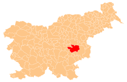
 Orešje nad Sevnico Location in Slovenia | |
| Coordinates: 46°3′0.61″N 15°17′53.22″E | |
| Country | |
| Traditional region | Styria |
| Statistical region | Lower Sava |
| Municipality | Sevnica |
| Area | |
| • Total | 2.18 km2 (0.84 sq mi) |
| Elevation | 262.1 m (859.9 ft) |
| Population (2002) | |
| • Total | 173 |
| [1] | |
Name
The name of the settlement was changed from Orešje to Orešje nad Sevnico in 1953.[3]
gollark: Horrible as in inconsistent.
gollark: Not in that file but whatever.
gollark: ```luafunction Element:calcSize(queue, stack) if self.finalizeSize then self.parent.container = self.parent.container + self.container self.finalizeSize = nil return end if self.parent then self.container = new(class.ElementRect)(self.parent.container) self.finalizeSize = true else self.container = new(class.ElementRect)(nil, self.browserObject.request.page.window, nil, 0, 0) end stack:push(self.container) if self.window then stack:push(new(class.ElementRect)(self.container, self.window)) end if self.parent then queue:push(self) end for i=#self.children, 1, -1 do queue:push(self.children[i]) endend```
gollark: Also, this is not "compiling".
gollark: The indentation is *horrible* and so's the lack of comments.
References
- Statistical Office of the Republic of Slovenia Archived November 18, 2008, at the Wayback Machine
- Sevnica municipal site
- Spremembe naselij 1948–95. 1996. Database. Ljubljana: Geografski inštitut ZRC SAZU, DZS.
External links
This article is issued from Wikipedia. The text is licensed under Creative Commons - Attribution - Sharealike. Additional terms may apply for the media files.