Orangeville Township, Orange County, Indiana
Orangeville Township is one of ten townships in Orange County, Indiana, United States. As of the 2010 census, its population was 658 and it contained 278 housing units.[1]
Orangeville Township | |
|---|---|
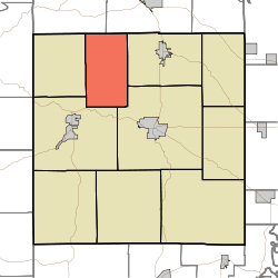 Location in Orange County | |
| Coordinates: 38°38′14″N 86°33′13″W | |
| Country | |
| State | |
| County | Orange |
| Government | |
| • Type | Indiana township |
| Area | |
| • Total | 28.11 sq mi (72.8 km2) |
| • Land | 28.01 sq mi (72.5 km2) |
| • Water | 0.1 sq mi (0.3 km2) 0.36% |
| Elevation | 522 ft (159 m) |
| Population (2010) | |
| • Total | 658 |
| • Density | 23.5/sq mi (9.1/km2) |
| Time zone | UTC-5 (Eastern (EST)) |
| • Summer (DST) | UTC-4 (EDT) |
| ZIP codes | 47452, 47454, 47469 |
| Area code(s) | 812, 930 |
| GNIS feature ID | 453692 |
Geography
According to the 2010 census, the township has a total area of 28.11 square miles (72.8 km2), of which 28.01 square miles (72.5 km2) (or 99.64%) is land and 0.1 square miles (0.26 km2) (or 0.36%) is water.[1]
Unincorporated towns
(This list is based on USGS data and may include former settlements.)
Cemeteries
The township contains Independent Order of Odd Fellows Cemetery.
School districts
- Orleans Community Schools
Political districts
- Indiana's 9th congressional district
- State House District 62
- State Senate District 48
gollark: No, magic as in running Lua as a secondary language within your existing program.
gollark: It's probably simpler than doing some sort of magic to run Lua on the server, though since Chervil has used JS for some stupid reason that should be easier to use.
gollark: Makes sense.
gollark: If you *need* fancy dynamic configuration, then running a programming language is probably good, but that's rarely important.
gollark: I mean, JSON is good for simple static files.
References
- "Orangeville Township, Orange County, Indiana". Geographic Names Information System. United States Geological Survey. Retrieved 2009-10-17.
- United States Census Bureau 2008 TIGER/Line Shapefiles
- IndianaMap
- "Population, Housing Units, Area, and Density: 2010 - County -- County Subdivision and Place -- 2010 Census Summary File 1". United States Census. Archived from the original on 2020-02-12. Retrieved 2013-05-10.
External links
- Indiana Township Association
- United Township Association of Indiana
- City-Data.com page for Orangeville Township
Places adjacent to Orangeville Township, Orange County, Indiana | |
|---|---|
Municipalities and communities of Orange County, Indiana, United States | ||
|---|---|---|
| Towns | Map of Indiana highlighting Orange County | |
| Townships | ||
| Unincorporated communities |
| |
| Footnotes | ‡This populated place also has portions in an adjacent county or counties | |
This article is issued from Wikipedia. The text is licensed under Creative Commons - Attribution - Sharealike. Additional terms may apply for the media files.