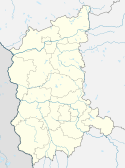
Ochla, Lubusz Voivodeship
Ochla [ˈɔxla] (German: Ochelhermsdorf) is a district of the city of Zielona Góra, in western Poland,[1] located in the southern part of the city. It was a separate village until 2014.
Ochla | |
|---|---|
District of Zielona Góra | |
Vinemaker house in heritage park | |
.jpg) Flag .jpg) Coat of arms | |
 Ochla  Ochla | |
| Coordinates: 51°52′30″N 15°28′0″E | |
| Country | |
| Voivodeship | Lubusz |
| County/City | Zielona Góra |
| Population | 1,544 |
| Time zone | UTC+1 (CET) |
| • Summer (DST) | UTC+2 (CEST) |
| Area code(s) | +48 68 |
| Vehicle registration | FZ |
Ochla has a population of 1,544.
History
Ochla has existed since 13th century and it came into being at the edge of the forest. Both Polish and the common German name which used to function among the inhabitants of Ochla testify to it, "Lednicza" (Old Polish: "clearing") and "Romisdorf" (there was a couple of variants of the name), respectively.
Historic buildings
- Holy Trinity parish church [2] – Gothic of the 13th century' built of field stone and turfy ore.
- Palace of the 13th century.
- Manor house of the 17th century.
- In the eastern part of the village there is a railway station of the disused railway of Szprotawa.
Sport
There is a football club in Ochla: LKS Zorza Ochla
gollark: Upgrading some of the solar swarm with better comms and computers would allow so very much research.
gollark: We already have a mining swarm on some moon or other.
gollark: ... not in that form.
gollark: In the Eldraeverse, yes.
gollark: Also, any new computing systems would fit well in the power beaming solar swarm of doom, where there's lots of power and presumably decent networking and cooling.
References
- "Central Statistical Office (GUS) – TERYT (National Register of Territorial Land Apportionment Journal)" (in Polish). 2008-06-01.
- "Official Website of the Zielonogórsko-Gorzowska Diocese" (in Polish). 2010-12-09.
This article is issued from Wikipedia. The text is licensed under Creative Commons - Attribution - Sharealike. Additional terms may apply for the media files.