Ochchuguy-Botuobuya
The Ochchuguy-Botuobuya (Russian: Оччугуй-Ботуобуя;[1] Yakut: Оччугуй Ботуобуйа) is a river in the Republic of Sakha in Russia. It is a right hand tributary of the Vilyuy, and is 342 kilometres (213 mi) long, with a drainage basin of 11,100 square kilometres (4,300 sq mi).[2]
| Ochchuguy-Botuobuya | |
|---|---|
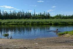 View of the river in the summer | |
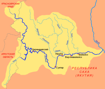
 Location in the Sakha Republic, Russia | |
| Native name | Оччугуй Ботуобуйа |
| Location | |
| Country | Yakutia, Russia |
| Physical characteristics | |
| Source | |
| • location | Lena Plateau |
| • coordinates | 61°37′4″N 114°12′26″E |
| • elevation | 317 m (1,040 ft) |
| Mouth | Vilyuy |
• coordinates | 63°4′37″N 113°31′19″E |
• elevation | 158 m (518 ft) |
| Length | 342 km (213 mi) |
| Basin size | 11,100 km2 (4,300 sq mi) |
| Discharge | |
| • average | 40 m3/s (1,400 cu ft/s) |
| Basin features | |
| Progression | Vilyuy→ Lena→ Laptev Sea |
Course
The river begins in the Lena Plateau at an elevation of 317 metres (1,040 ft). It flows roughly northwards through a wide valley with the larger Ulakhan-Botuobuya runnning parallel to it further to the west. Finally it joins river Vilyuy from the right near Khampa village. The river freezes between October and late May.[3]
The main tributaries of the Ochchuguy-Botuobuya are the Irelyakh and the Kharya Yuryakh. The town of Almazny is located at the confluence of the Ochchuguy Botuobuya and the Irelyakh.[4]
 The T-shaped Chona-Vilyuy River system. |
See also
References
- Словарь названий гидрографических объектов России и других стран — членов СНГ, Federal Service for Geodesy and Cartography of Russia, 1999, p. 291
- Река Оччугуй-Ботуобуйа in the State Water Register of Russia (Russian)
- Geographic Encyclopedic Dictionary: Geographic Names / A.F. Treshnikov (ed.) - 2nd ed., Ext. - M . Great Soviet Encyclopedia
- Russia. Topographic map P-50-XIX, XX . Scale: 1: 200 000
External links

- Geography - Yakutia Organized