Number Ten Creek
Number Ten Creek is a creek in the Moira River and Lake Ontario drainage basins in Belleville, Hastings County, Ontario, Canada.
| Number Ten Creek | |
|---|---|
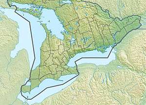
 Location of the mouth of Number Ten Creek in southern Ontario. | |
| Location | |
| Country | Canada |
| Province | Ontario |
| Region | Central Ontario |
| County | Hastings |
| Municipality | Belleville |
| Physical characteristics | |
| Source | Unnamed field |
| • coordinates | 44°20′48″N 77°22′36″W |
| • elevation | 139 m (456 ft) |
| Mouth | Chrysal Creek |
• coordinates | 44°16′50″N 77°23′55″W |
• elevation | 104 m (341 ft) |
| Length | 13.1 km (8.1 mi) |
| Basin features | |
| River system | Great Lakes Basin |
Course
Number Ten Creek begins in an unnamed field at an elevation of 139 metres (456 ft) about 2.7 kilometres (1.7 mi) southeast of the community of Moira. It flows west into an unnamed pond where it takes in an unnamed right tributary, then turns south. The creek continues to the east of the community of Phillipston, then heads southwest through the community of Zion Hill. Finally, it turns southeast and reaches its mouth at Chrysal Creek, at an elevation of 104 metres (341 ft), which flows via the Moira River into the Bay of Quinte in downtown Belleville.
gollark: Much better than the horror of YAML.
gollark: Common stuff can get away without the quotes and with some extra consistency/safety.
gollark: TOML does still allow weird stuff like, say, IP addresses, to be handled as strings.
gollark: Look at JSON.
gollark: If you don't have a consistent format for dates and whatnot, bad things happen.
See also
References
- "Number Ten Creek". Geographical Names Data Base. Natural Resources Canada. Retrieved 2010-03-14.
- "Toporama - Topographic Map Sheet 31C6". Atlas of Canada. Natural Resources Canada. Retrieved 2010-03-14.
This article is issued from Wikipedia. The text is licensed under Creative Commons - Attribution - Sharealike. Additional terms may apply for the media files.