Nossa Senhora do Rosário (Ribeira Brava)
Nossa Senhora do Rosário is a freguesia (civil parish) of Cape Verde. It covers the larger eastern part of the municipality of Ribeira Brava, on the island of São Nicolau.
Nossa Senhora do Rosário | |
|---|---|
Civil parish | |
 Nossa Senhora do Rosário | |
| Coordinates: 16.61°N 24.21°W | |
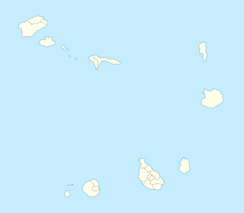
| Country | Cape Verde |
| Island | São Nicolau |
| Municipality | Ribeira Brava |
| Population (2010)[1] | |
| • Total | 6,169 |
| ID | 312 |
Subdivisions
The freguesia consists of the following settlements (population at the 2010 census):
- Água das Patas (pop: 108)
- Belém (pop: 132)
- Boqueirão (pop: 15)
- Cachaço (pop: 393)
- Caleijão (pop: 300)
- Campinho (pop: 266)
- Canto Fajã (pop: 238)
- Carriçal (pop: 190)
- Carvoeiros (pop 199)
- Chã de Norte (pop: 17)
- Figueira de Cocho (pop: 1)
- Juncalinho (pop: 433, town)[2]
- Lompelado (pop: 416)
- Morro (pop: 146)
- Morro Brás (pop: 188)
- Pico Agudo (pop: 118)
- Pombas (pop: 125)
- Preguiça (pop: 567)
- Ribeira Brava (pop: 1,936, city)[2]
- Talho (pop: 308)
gollark: \lua return 5
gollark: This is what I have to do to access the backdoor from my phone. It is annoying.
gollark: ```~ $ ssh odinodin:~# ssh osmarks@192.168.1.25osmarks@192.168.1.25's password:osmarks@tyr ~> potatoconnected (press CTRL+C to quit)>```
gollark: Use YAFSS, Yet Another Filesystem Sandboxing System.
gollark: PotatOS has a custom (but somewhat decoupled) filesystem sandbox.
References
- "2010 Census results". Instituto Nacional de Estatística Cabo Verde (in Portuguese). 24 November 2016.
- Cabo Verde, Statistical Yearbook 2015, Instituto Nacional de Estatística, p. 32-33
The island of São Nicolau | ||||||
|---|---|---|---|---|---|---|
| Ribeira Brava |
| 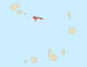 | ||||
| Tarrafal de São Nicolau |
| |||||
| Mountains | ||||||
| Other topics | ||||||
This article is issued from Wikipedia. The text is licensed under Creative Commons - Attribution - Sharealike. Additional terms may apply for the media files.