Norwegian County Road 680
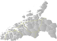
Norwegian County Road 680 (Norwegian: Fylkesvei 680) is a road in the municipalities of Kristiansund and Aure in Møre og Romsdal county and Heim in Trøndelag county, Norway. In addition to its 111.6-kilometer (69.3 mi) land length (67.5 kilometers or 41.9 miles in Møre og Romsdal and 44.1 kilometers or 27.4 miles in Trøndelag), the route also includes the 7.0-kilometer (4.3 mi) Seivika–Tømmervåg Ferry across the Talgsjø channel.[1][2]
| ||||
|---|---|---|---|---|
| Bokmål: Fylkesvei 680 Nynorsk: Fylkesveg 680 | ||||
  | ||||
| Route information | ||||
| Maintained by Norwegian Public Roads Administration | ||||
| Length | 111.6 km (69.3 mi) | |||
| Major junctions | ||||
| West end | ||||
| East end | ||||
| Location | ||||
| Counties | Møre og Romsdal, Trøndelag | |||
| Major cities | Kristiansund, Vinjeøra, Kyrksæterøra | |||
| Highway system | ||||
County Roads in Norway
| ||||
The route starts in Øygarden in Kristiansund, where it branches off from European route E70, and runs west to Seivika, from which there is a ferry to Tømmervåg on the island of Tustna.[3] It then takes a meandering coastal route eastward through the municipality of Aure to Svanem in Trøndelag, where it turns south and runs through Kyrksæterøra before meeting European route E39 in Stormyra, just outside Vinjeøra.[3]
Prior to January 1, 2010, the route was a Norwegian national road, but control and maintenance of the road was transferred to the counties from the national government on that date, and so now it is a Norwegian county road.
References
- Killingberg, Alexander; Hanssen, Torsten; Kilnes, Camilla (November 25, 2011). "Hurtigbåten stoppet av stormen". adressa.no. Retrieved 2019-07-15.
- Kilnes, Camilla; Ytterlandnygård, Marit; Ringseth, Birger; Bjørkli, Jonas (November 27, 2013). "Innstiller båtruter langs kysten på grunn av storm". adressa.no. Retrieved 2019-07-15.
- "Vegliste 2017: Fylkes- og kommunale veger. Møre og Romsdal" (PDF). Retrieved 2019-07-15.
