Northcote, New Zealand
Northcote is a suburb of Auckland in northern New Zealand. It is situated on the North Shore, on the northern shores of Waitematā Harbour, four km northwest of Auckland CBD. The suburb includes the peninsula of Northcote Point and the northern approaches to the Auckland Harbour Bridge. Northcote Central is to the north of Northcote.
Northcote | |
|---|---|
Suburb | |
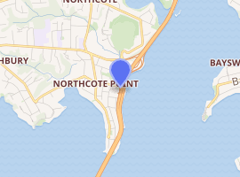
Location | |
| Country | New Zealand |
| Local authority | Auckland Council |
| Population (2018) | |
| • Total | 5,742 |
| Postcode(s) | 0627 |
| Birkenhead | Northcote Central | Takapuna |
| Birkenhead |
|
Shoal Bay |
| (Waitematā Harbour) | Waitematā Harbour | Waitematā Harbour |
Demographics
| Year | Pop. | ±% p.a. |
|---|---|---|
| 2006 | 5,229 | — |
| 2013 | 5,349 | +0.32% |
| 2018 | 5,742 | +1.43% |
| Source: [1] | ||
Northcote, comprising the statistical areas of Northcote South (Auckland) and Northcote Point (Auckland), had a population of 5,742 at the 2018 New Zealand census, an increase of 393 people (7.3%) since the 2013 census, and an increase of 513 people (9.8%) since the 2006 census. There were 1,959 households. There were 2,751 males and 2,991 females, giving a sex ratio of 0.92 males per female, with 1,041 people (18.1%) aged under 15 years, 1,185 (20.6%) aged 15 to 29, 2,718 (47.3%) aged 30 to 64, and 792 (13.8%) aged 65 or older.
Ethnicities were 73.6% European/Pākehā, 7.7% Māori, 3.7% Pacific peoples, 21.9% Asian, and 2.7% other ethnicities (totals add to more than 100% since people could identify with multiple ethnicities).
The proportion of people born overseas was 36.1%, compared with 27.1% nationally.
Although some people objected to giving their religion, 53.1% had no religion, 34.7% were Christian, and 7.2% had other religions.
Of those at least 15 years old, 1,941 (41.3%) people had a bachelor or higher degree, and 354 (7.5%) people had no formal qualifications. The employment status of those at least 15 was that 2,583 (54.9%) people were employed full-time, 717 (15.3%) were part-time, and 138 (2.9%) were unemployed.[1]
History
In 1882, the St Heliers and Northcote Land Company was formed and some land in the area was subdivided. In 1889 a major subdivision was the result when the Bartley Estate was auctioned. Before the construction of the Harbour Bridge, the Northcote Wharf was heavily utilised by Auckland Harbour ferry services. After the bridge was opened in 1959, the number of ferry crossings fell and the Northcote Point peninsula became a quiet cul-de-sac. The wooden Northcote Tavern was once in the thick of things; it still stands but now surveys a quiet streetscape.
Local government
Northcote had a local government just like other suburbs in Auckland at that time. The local government was called Northcote Borough Council, which started in 1908 and merged into North Shore City Council in 1989. It then amalgamated into Auckland Council in November 2010.
Mayors of Northcote Borough Council
- 1908 Alexander Bruce
- 1908–1912 Herbert Cadness
- 1912–1917 George Fraser
- 1917–1919 John Byrne Tonar
- 1919–1921 Arthur Edwin Greenslade
- 1921–1925 William Ernest Richardson
- 1925–1927 Charles Archibald Deuxberry
- 1927–1931 Arthur Edwin Greenslade
- 1931–1941 Robert Martin
- 1941–1944 Ernest Clyde Fowler
- 1944–1956 Frank Montagne Pearn
- 1956–1962 John Forsyth Potter
- 1962–1968 Albert Ernest James Holdaway
- 1968–1974 Alfred James Evans
- 1974–1979 Trevor Edwin La Roche
- 1979–1989 Jean Sampson
Features and landmarks
Northcote is surrounded by the suburbs of Birkenhead, Hillcrest and Takapuna to the west and north, and the waters of Shoal Bay, an arm of the Waitemata, to the south and east.[2] State Highway 1 stretches along the waterfront of Shoal Bay, heading north from the bridge towards Albany.
To the north of Northcote Point on one of the main routes leading to and from the Harbour Bridge is the Northcote Shopping Centre, which was developed in the early 1960s. It is now a multi-cultural retail hub featuring many Asian food outlets.
Education
Northcote College is a coeducational secondary (years 9–13) school with a roll of 1159.[3] It was established in 1877.[4]
During its early years, the College incorporated Standards five and six (Forms one and two) which were transferred to Northcote Intermediate School when that was established as a separate entity on its present site in Lake Road in Northcote Central in 1958.
Northcote Primary School is a coeducational contributing primary (years 1–6) school with a roll of 431.[5] It was established on its present site in 1918.[6] The Northcote area war memorial stands at the front of the school, on the corner of Lake and Onewa Roads.
St Mary's School is a primary school with a roll of 358.[7] It is a state integrated Catholic school, which provides education for both boys and girls in years 1–6, and for girls only in years 7–8.[8] It celebrated its 75th Jubilee in 2008.[9]
Rolls are as of March 2020.[10]
Sport and recreation
Northcote is home to the Northcote Tigers rugby league club and the Northcote Birkenhead Rugby Union Sports Club.
Transport
Auckland ferry services run by Fullers Group stop at Northcote Point, near the northern end of the Auckland Harbour Bridge.
References
- "Statistical area 1 dataset for 2018 Census". Statistics New Zealand. March 2020. Northcote South (Auckland) (127300) and Northcote Point (Auckland) (128200). 2018 Census place summary: Northcote South (Auckland) 2018 Census place summary: Northcote Point (Auckland)
- Education Counts: Northcote College
- "Celebrating 131 Years of Excellence". Northcote College. Archived from the original on 10 May 2007. Retrieved 27 January 2009.
- Education Counts: Northcote School
- "Our School". Northcote School. Archived from the original on 22 February 2009. Retrieved 27 January 2009.
- Education Counts: St Mary's School
- "About Us". St Mary's School. Archived from the original on 8 February 2007. Retrieved 27 January 2009.
- "75th Jubilee 2008". St Mary's School. Archived from the original on 24 July 2011. Retrieved 27 January 2009.
- "New Zealand Schools Directory". New Zealand Ministry of Education. Retrieved 26 April 2020.
Further reading
- Hodgson, Terence (1992). The Heart of Colonial Auckland, 1865–1910. Random Century NZ.
External links
- Photographs of Northcote held in Auckland Libraries' heritage collections.
- Photographs of Northcote Point held in Auckland Libraries' heritage collections.