Northbourne Avenue
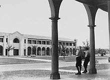
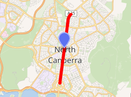
Northbourne Avenue is a major road in Canberra, Australia. It extends from City Hill in the south to the Federal Highway in the north. Its northern end is at the intersection with Antill and Mouat streets, but it is often considered to extend over the southern end of the Federal Highway to the intersection with the Barton Highway.
Northbourne Avenue | |
|---|---|
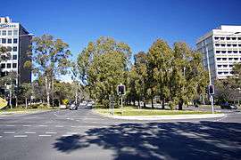 | |
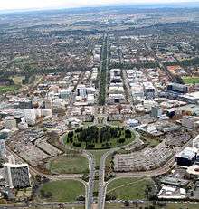
Looking south along Northbourne Avenue, at the intersection of Macarthur Avenue (west) / Wakefield Avenue (east) | |
| |
 Northbourne Avenue | |
| Coordinates | |
| General information | |
| Type | Highway |
| Length | 4.52 km (2.8 mi) |
| Gazetted | 20 September 1928 |
| Route number(s) |
|
| Former route number |
|
| Major junctions | |
| South end |
|
| |
| North end |
|
| Location(s) | |
| Major suburbs | City, Braddon, Turner, Dickson, Lyneham, Downer |
| Highway system | |
It is a north–south running road which has three lanes for motorised traffic, and one lane for bicycles running in each direction, with a large median strip containing a light railway line between rows of trees. The speed limit is 60 km/h. The Federal Highway to the north of the intersection with Mouat and Antill streets has an 80 km/h speed limit. These speed limits are strictly enforced with multiple fixed red light/speed cameras in the 60 km/h zone and mobile speed cameras being permitted to operate along the entire length of the road.
Northbourne Avenue is the dividing line between the suburbs of Turner and Lyneham on the west, with the suburbs of Braddon, Dickson and Downer on the east.
Many ACTION buses travelling between City and Dickson, Gungahlin or Belconnen used the road, which had many bus stops along it until the light rail line along the median strip opened in April 2019.[1]
Northbourne Avenue was planted with Eucalyptus elata (river peppermint gums) between 1983 and 1986, the third generation of Eucalyptus on the road.[2] The previous generation was Corymbia maculata (spotted gums). The river peppermint gums were cleared for Capital Metro and replanted with Eucalyptus mannifera (brittle gums).[3]
References
- "Routes and Stops". Transport Canberra. Retrieved 18 April 2017.
- "First Northbourne tree removals costing $32,000". The Canberra Times. 26 April 2016. Retrieved 4 February 2017.
- "Frequently Asked Questions". Transport Canberra. Retrieved 4 February 2017.
See also
![]()
External links
![]()
| Controlled-access roads: | ||
|---|---|---|
| Limited-access roads: |
| |
| Major interchanges: | ||
*Partially limited-access ^Partially controlled-access roadway under construction | ||