Nong Muang Khai District
Nong Muang Khai District (Thai: หนองม่วงไข่, pronounced [nɔ̌ːŋ mûa̯ŋ kʰàj]) is a district (amphoe) in the central part of Phrae Province, northern Thailand.
Nong Muang Khai หนองม่วงไข่ | |
|---|---|
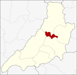 District location in Phrae Province | |
| Coordinates: 18°15′53″N 100°11′24″E | |
| Country | Thailand |
| Province | Phrae |
| Seat | Nong Muang Khai |
| Area | |
| • Total | 221.65 km2 (85.58 sq mi) |
| Population (2005) | |
| • Total | 19,302 |
| Time zone | UTC+7 (ICT) |
| Postal code | 54170 |
| Geocode | 5408 |
History
The minor district (king amphoe) Nong Muang Khai was established on 1 April 1990 from tambons Mae Kham Mi and Nong Muang Khai of Rong Kwang District and Wang Luang and Nam Rat of Song District. It was made a subordinate of Rong Kwang District.[1] It was upgraded to a full district on 7 September 1995.[2]
Geography
Neighboring districts are (from the north clockwise): Song, Rong Kwang, Mueang Phrae, and Long.
Administration
The district is divided into six sub-districts (tambons), which are further subdivided into 34 villages (mubans). Nong Muang Khai is a township (thesaban tambon) and covers most parts of tambon Nong Muang Khai. There are a further five tambon administrative organizations (TAO).
| No. | Name | Thai name | Villages | Pop. | |
|---|---|---|---|---|---|
| 1. | Mae Kham Mi | แม่คำมี | 4 | 2,262 | |
| 2. | Nong Muang Khai | หนองม่วงไข่ | 8 | 4,853 | |
| 3. | Nam Rat | น้ำรัด | 6 | 3,594 | |
| 4. | Wang Luang | วังหลวง | 5 | 2,716 | |
| 5. | Tamnak Tham | ตำหนักธรรม | 7 | 3,549 | |
| 6. | Thung Khaeo | ทุ่งแค้ว | 4 | 2,328 |
References
- ประกาศกระทรวงมหาดไทย เรื่อง แบ่งเขตท้องที่อำเภอร้องกวาง จังหวัดแพร่ ตั้งเป็นกิ่งอำเภอหนองม่วงไข่ (PDF). Royal Gazette (in Thai). 107 (25 ง): 2533. February 13, 1990.
- พระราชกฤษฎีกาตั้งอำเภอด่านมะขามเตี้ย อำเภอแก่งหางแมว อำเภอภักดีชุมพล อำเภอเวียงแก่น อำเภอแม่วาง อำเภอถ้ำพรรณรา อำเภอบ่อเกลือ อำเภอโนนสุวรรณ อำเภอห้วยราช อำเภอแม่ลาน อำเภอบางแก้ว อำเภอป่าพะยอม อำเภอหนองม่วงไข่ อำเภอยางสีสุราช อำเภอจังหาร อำเภอบ้านธิ อำเภอภูสิงห์ อำเภอบางกล่ำ อำเภอวังม่วง และอำเภอนายูง พ.ศ. ๒๕๓๘ (PDF). Royal Gazette (in Thai). 112 (32 ก): 1–3. August 8, 1995.