Niua Islands
Niua is a division of the Kingdom of Tonga, namely the northernmost group of islands. It consists of three islands (Niuafoʻou, Niuatoputapu and Tafahi) which together have an area of 71.69 km2 and a population of 1,232. The largest village is Hihifo on Niuatoputapu. Piu'o Tafahi is the highest point with an elevation of 560 m.
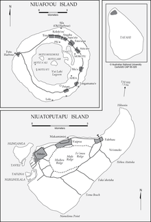
Map of Niua Islands
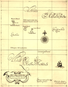
Futuna, Alofi, Niuafo'ou, Niuatoputapu and Tafahi drawn on a 1646 map by Robert Dudley. In 1616, Dutch explorers Le Maire and Schouten were the first Europeans to visit those islands.
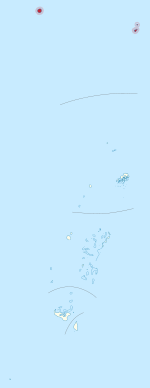 Location of Niua Islands in Tonga | |
| Geography | |
|---|---|
| Location | Pacific Ocean |
| Coordinates | 15°58′S 173°47′W |
| Archipelago | Tonga Islands |
| Total islands | 3 |
| Major islands | 2 |
| Area | 71.69 km2 (27.68 sq mi) |
| Highest elevation | 560 m (1,840 ft) |
| Highest point | Piu 'o Tafahi |
| Administration | |
Tonga | |
| Largest settlement | Hihifo, Niuatoputapu |
| Demographics | |
| Population | 1232 (2016) |
| Pop. density | 23.01/km2 (59.6/sq mi) |
| Ethnic groups | Tongan |
Geography
The islands are the peaks of undersea volcanoes, towering from the sea, some of which were still active until very recently.
History
The Niua group was encountered in 1616 by Willem Schouten and Jacob Le Maire Cornelisz during their circumnavigation with the ships and Eendracht Horn to Europe.
| Authority control |
|
|---|
gollark: ```osmarks@loki ~/epicbot/epicbot % ls -l antimemetic-gtech -rw-r--r-- 1 osmarks osmarks 0 Nov 26 21:10 antimemetic-gtech```
gollark: Troubling. However, I created decoy files for this eventuality.
gollark: Oh, I worked that out ages ago and reused that extra [REDACTED] for EXULTED STANDOFFS.
gollark: I have now limited it to 10% of memory.
gollark: Resolved. I found out that it was heavpoot's fault for programming epicbot so awfully.
This article is issued from Wikipedia. The text is licensed under Creative Commons - Attribution - Sharealike. Additional terms may apply for the media files.