Nienstädt
Nienstädt is a municipality in the district of Schaumburg, in Lower Saxony, Germany. It is situated approximately 4 km southwest of Stadthagen, and 17 km east of Minden.
Nienstädt | |
|---|---|
Location of Nienstädt within Schaumburg district 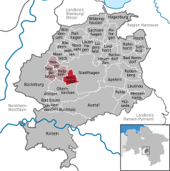  | |
 Nienstädt 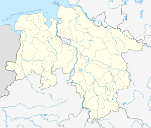 Nienstädt | |
| Coordinates: 52°17′21″N 9°10′7″E | |
| Country | Germany |
| State | Lower Saxony |
| District | Schaumburg |
| Municipal assoc. | Nienstädt |
| Subdivisions | 4 |
| Government | |
| • Mayor | Gerhard Widdel (SPD) |
| Area | |
| • Total | 8.31 km2 (3.21 sq mi) |
| Elevation | 104 m (341 ft) |
| Population (2018-12-31)[1] | |
| • Total | 4,491 |
| • Density | 540/km2 (1,400/sq mi) |
| Time zone | CET/CEST (UTC+1/+2) |
| Postal codes | 31688 |
| Dialling codes | 05721, 05724 |
| Vehicle registration | SHG |
Nienstädt is part of the Samtgemeinde ("collective municipality") Nienstädt.
Geography
Nienstädt lies on the northern slopes of the Bückeberge between Bückeburg and Stadthagen on the B 65 federal highway.
The four parishes in the municipality are Sülbeck, Liekwegen, Wackerfeld and Meinefeld. While Sülbeck and Nienstädt are bisected by the B 65, Liekwegen runs along the Bückeberg as a ribbon village. Wackerfeld and Meinefeld lie in open country north of Nienstädt.
Neighbouring communities (clockwise) are the towns of Stadthagen and Obernkirchen and the village of Helpsen.
gollark: * osmarks internet radio™
gollark: Opinions on Apiotelephone™ so far?
gollark: ddg! download entire internet.
gollark: ddg!ebay rubber duck
gollark: oh apiobees.
References
This article is issued from Wikipedia. The text is licensed under Creative Commons - Attribution - Sharealike. Additional terms may apply for the media files.