Niederhosenbach
Niederhosenbach is an Ortsgemeinde – a municipality belonging to a Verbandsgemeinde, a kind of collective municipality – in the Birkenfeld district in Rhineland-Palatinate, Germany. It belongs to the Verbandsgemeinde Herrstein-Rhaunen, whose seat is in Herrstein.
Niederhosenbach | |
|---|---|
 Coat of arms | |
Location of Niederhosenbach within Birkenfeld district 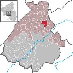 | |
 Niederhosenbach  Niederhosenbach | |
| Coordinates: 49°47′43″N 7°22′51″E | |
| Country | Germany |
| State | Rhineland-Palatinate |
| District | Birkenfeld |
| Municipal assoc. | Herrstein-Rhaunen |
| Government | |
| • Mayor | Helmut Hey |
| Area | |
| • Total | 7.43 km2 (2.87 sq mi) |
| Elevation | 360 m (1,180 ft) |
| Population (2018-12-31)[1] | |
| • Total | 289 |
| • Density | 39/km2 (100/sq mi) |
| Time zone | CET/CEST (UTC+1/+2) |
| Postal codes | 55758 |
| Dialling codes | 06785 |
| Vehicle registration | BIR |
Geography
Location
The municipality lies north of the river Nahe between Kirn and Herrstein. The municipal area is 43.4% wooded.
Neighbouring municipalities
Niederhosenbach's neighbours are Herrstein, Breitenthal, Wickenrodt, Sonnschied, Griebelschied and Bergen.
Constituent communities
Also belonging to Niederhosenbach are the outlying homesteads of “Auf dem Büchelchen”, “Heupenmühle” and “Zwischen den Seen”.[2]
History
Vanished village
South of Niederhosenbach, on the Hosenbach's left bank before the “Allholz” woods and opposite the Etzelberg (mountain) once stood a village named Hitzelhosenbach. A plaque at the site recalls the now long-vanished village. Standing at the spot where the road from Niederhosenbach to Fischbach crosses the brook was the Etzelberger Mühle (mill), which burnt down in 1913.[3]
Politics
Municipal council
The council is made up of 8 council members, who were elected by majority vote at the municipal election held on 7 June 2009, and the honorary mayor as chairman.[4]
Mayor
Niederhosenbach's mayor, who has held office since 2007, is Helmut Hey, and his deputies are Thomas Heylmann and Markus Schnurr.[5]
Coat of arms
The German blazon reads: In schräglinks geteiltem Schild vorne in Silber über blauem Wellenschrägbalken die blauen Buchstaben N und H, hinten rot-silbernes Schach, belegt mit einem schwarzen Dreiberg.
The municipality's arms might in English heraldic language be described thus: Per bend sinister argent a bend wavy abased above which the letters N and H in bend, and chequy gules and argent issuant from base a mount of three sable.
The letters N and H on the dexter (armsbearer's right, viewer's left) side refer to the municipality's name, as does the wavy bend (slanted stripe; the ending —bach means “brook” in German), while the “chequy” field on the sinister (armsbearer's left, viewer's right) side is a reference to the village's former allegiance to the County of Sponheim, and the mount of three – a charge called a Dreiberg in German heraldry – stands for the Amt within the County of Sponheim in which Niederhosenbach lay, namely Herrstein (whose name literally means “Lordstone”). Niederhosenbach even today lies in a Verbandsgemeinde of that same name.[6]
Culture and sightseeing
Buildings
The following are listed buildings or sites in Rhineland-Palatinate’s Directory of Cultural Monuments:[7]
- Evangelical church, Kirchstraße 5 – Late Gothic quire, marked 1518; Gothic Revival nave, 1842-1844; essentially mediaeval tower (Romanesque?), belfry 1842; Stumm organ, 1896; bell, 1894 by Jakob Pfeiffer, Kaiserslautern
- Fischbachstraße 1 – house, Renaissance Revival, 1880s
- Hauptstraße 39 – Quereinhaus (a combination residential and commercial house divided for these two purposes down the middle, perpendicularly to the street), partly timber-frame (plastered), Baroque dwelling section marked 1786
- Talstraße 9 – scattered estate; house from earlier half of the 19th century, bakehouse, stables
- Bridge, east of the village – one-arch quarrystone bridge over a tributary to the Hosenbach
Economy and infrastructure
Transport
Running southeast of the municipality is Bundesstraße 41. Serving nearby Fischbach is a railway station on the Nahe Valley Railway (Bingen–Saarbrücken).
References
- "Bevölkerungsstand 2018 - Gemeindeebene". Statistisches Landesamt Rheinland-Pfalz (in German). 2019.
- Statistisches Landesamt Rheinland-Pfalz – Amtliches Verzeichnis der Gemeinden und Gemeindeteile Archived 2015-11-25 at the Wayback Machine, Seite 20 (PDF)
- "Hitzelhosenbach". Archived from the original on 2012-04-25. Retrieved 2011-10-15.
- Kommunalwahl Rheinland-Pfalz 2009, Gemeinderat
- "Niederhosenbach's council". Archived from the original on 2012-04-25. Retrieved 2011-10-15.
- "Description and explanation of Niederhosenbach's arms". Archived from the original on 2012-04-25. Retrieved 2011-10-15.
- Directory of Cultural Monuments in Birkenfeld district
External links
- Municipality’s official webpage (in German)