Ngamatapouri
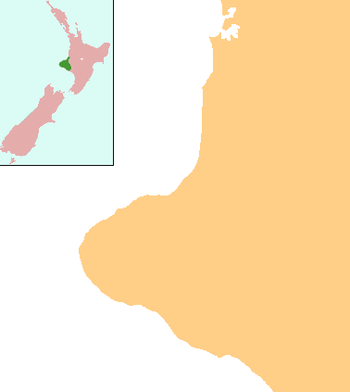
Ngamatapouri is a small rural locality[1] in the Waitotara River valley, 47 km north of Waitotara village, in south Taranaki, New Zealand.[2][3] Wanganui is about 80 km to the southeast. The road is sealed as far as the school.[4]
Ngamatapouri | |
|---|---|
 Ngamatapouri | |
| Coordinates: 39°34′24″S 174°49′29″E | |
| Country | New Zealand |
| Region | Taranaki |
| District | South Taranaki District |
The New Zealand Ministry for Culture and Heritage gives a translation of "the black teals" for Ngāmatapōuri.[5]
Community life centres on Ngamatapouri School. The area is predominantly reliant on sheep and beef pastoral farming.
Education
Ngamatapouri School is a coeducational full primary (years 1–8) school with a decile rating of 4 and a roll of 9.[6]
gollark: Oh, those arguably completely useless things, yes.
gollark: No it's not.
gollark: Ah, like in lisps, kind of.
gollark: What are these fancy-sounding things?
gollark: That's a better idea. Maybe ask the entire simulated population of Earth too.
References
- "Place name detail: Ngamatapouri". New Zealand Gazetteer. Land Information New Zealand. Retrieved 15 May 2018.
- Peter Dowling (editor) (2004). Reed New Zealand Atlas. Reed Books. pp. map 44. ISBN 0-7900-0952-8.CS1 maint: extra text: authors list (link)
- Roger Smith, GeographX (2005). The Geographic Atlas of New Zealand. Robbie Burton. pp. map 98. ISBN 1-877333-20-4.
- "Ngamatapouri School".
- "1000 Māori place names". New Zealand Ministry for Culture and Heritage. 6 August 2019.
- Education Counts: Ngamatapouri School
This article is issued from Wikipedia. The text is licensed under Creative Commons - Attribution - Sharealike. Additional terms may apply for the media files.