New Mexico State Road 522
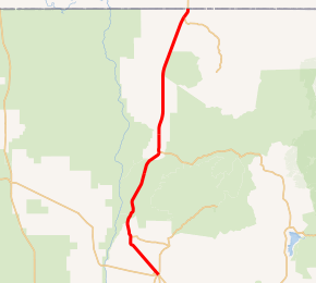
State Road 522 (NM 522) is a 41.096-mile-long (66.138 km) state highway in far northern New Mexico. NM 522's southern terminus is at U.S. Route 64 (US 64) and NM 150 approximately four miles north of Taos. From there, NM 522 heads north through Arroyo Hondo then Questa where it has a junction with NM 38. From there it continues north to Costilla before its northern terminus at the Colorado state line where the road becomes Colorado State Highway 159 (SH 159).
| ||||
|---|---|---|---|---|

NM 522 highlighted in red | ||||
| Route information | ||||
| Maintained by NMDOT | ||||
| Length | 41.096 mi[1] (66.138 km) | |||
| Major junctions | ||||
| South end | ||||
| North end | ||||
| Location | ||||
| Counties | Taos | |||
| Highway system | ||||
| ||||
Major intersections
The entire route is in Taos County.
| Location | mi[2] | km | Destinations | Notes | |
|---|---|---|---|---|---|
| | 0.000 | 0.000 | Southern terminus, southern terminus of NM 150 | ||
| | 16.575 | 26.675 | Southern terminus of NM 515 | ||
| Questa | 20.161 | 32.446 | Western terminus of NM 38 | ||
| | 22.760 | 36.629 | Eastern terminus of NM 378 | ||
| Costilla | 39.775 | 64.012 | Northern terminus of NM 196 | ||
| | 41.096 | 66.138 | Northern terminus | ||
| 1.000 mi = 1.609 km; 1.000 km = 0.621 mi | |||||
gollark: ... what?
gollark: Well, you're a heretic, as you are publicly dissenting from the officially accepted dogma of the Ericist religion.
gollark: Eric, you mean?
gollark: I duckduckgo'd it.
gollark: n. A person who holds controversial opinions, especially one who publicly dissents from the officially accepted dogma of the ~~Roman Catholic Church~~ Ericist religion.
See also

References
- "NMDOT State Routes" (PDF). New Mexico Department of Transportation. Retrieved 2008-03-26.
- "TIMS Road Segments by Posted Route/Point with AADT Info; NM, X-Routes" (PDF). New Mexico Department of Transportation. April 3, 2013. pp. 5–7. Retrieved December 20, 2013.
This article is issued from Wikipedia. The text is licensed under Creative Commons - Attribution - Sharealike. Additional terms may apply for the media files.
