New Mexico State Road 421
State Road 421 (NM 421) is a 8.101-mile-long (13.037 km) state highway in the U.S. state of New Mexico maintained by the New Mexico Department of Transportation (NMDOT). The road, located in southeastern Union County, begins at NM 402 between Amistad and Clayton and passes eastward through the town of Sedan to the Texas state line where the roadway continues as Texas State Highway 102 (SH 102) to U.S. Route 87 (US 87) near Dalhart, Texas. Before 1988, the road was part of a much longer NM 102.
| ||||
|---|---|---|---|---|

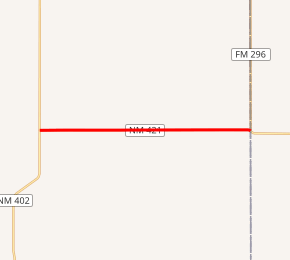
NM 421 highlighted in red | ||||
| Route information | ||||
| Maintained by NMDOT | ||||
| Length | 8.101 mi[1] (13.037 km) | |||
| Existed | 1988[2]–present | |||
| Major junctions | ||||
| West end | ||||
| East end | ||||
| Location | ||||
| Counties | Union | |||
| Highway system | ||||
| ||||
Route description
The 8.1-mile (13.0 km) two-lane road begins at a t-intersection with NM 402 south of Clayton and west of Sedan in rural Union County. The highway passes through farmland as it travels east before it enters the small town of Sedan, serving as the town's main east-west road. After leaving Sedan, the highway traverses more farmland before terminating at the New Mexico–Texas state line just west of Farm to Market Road 296 (FM 296). The highway continues east into Dallam County, Texas as Texas State Highway 102 (SH 102) until it terminates at US 87 northwest of Dalhart.[3]
History

NM 421 was originally designated as NM 102 between the current NM 402, then part of a northern extension of NM 18, and Sedan in the 1940s.[4] In the following decade, the road was extended southward along NM 18 then westward through Bueyeros and eastward to the state line meeting up with Texas's FM 808 which was then re-signed continuously as SH 102 in 1955.[4][5][6] Both NM 421 and NM 402 received their current designations during the 1988 renumbering of the New Mexico highway system.[2][7]
Major intersections
The entire route is in Union County.
| Location | mi[1] | km | Destinations | Notes | |
|---|---|---|---|---|---|
| | 0.000 | 0.000 | Western terminus | ||
| | 8.101 | 13.037 | Eastern terminus, roadway continues as SH 102 | ||
| 1.000 mi = 1.609 km; 1.000 km = 0.621 mi | |||||
See also

References
- "State Routes" (PDF). New Mexico Department of Transportation. p. 21. Archived from the original (PDF) on October 29, 2005. Retrieved December 1, 2010.
- Riner, Steve (November 2, 2009). "Details of New Mexico State Routes 401-450". The Unofficial New Mexico Highways Page. Retrieved 2010-12-04. External link in
|work=(help) - Google (December 1, 2010). "NM 421" (Map). Google Maps. Google. Retrieved December 1, 2010.
- Riner, Steve (May 21, 2009). "Details of New Mexico State Routes 101-125". The Unofficial New Mexico Highways Page. Retrieved 2010-12-04. External link in
|work=(help) - Transportation Planning and Programming Division (n.d.). "Farm to Market Road No. 808". Highway Designation Files. Texas Department of Transportation. Retrieved 2010-12-04.
- Transportation Planning and Programming Division (n.d.). "State Highway No. 102". Highway Designation Files. Texas Department of Transportation. Retrieved 2010-12-04.
- Riner, Steve (November 2, 2009). "Details of New Mexico State Routes 401-450". The Unofficial New Mexico Highways Page. Retrieved 2010-12-04. External link in
|work=(help)
External links
![]()
