New Brunswick Route 132
Route 132 is a New Brunswick provincial collector road that runs 27 kilometres (17 mi) between Dieppe and Shediac.
| ||||
|---|---|---|---|---|
| Route information | ||||
| Maintained by New Brunswick Department of Transportation | ||||
| Length | 27.0 km[1] (16.8 mi) | |||
| Existed | 1965–present | |||
| Major junctions | ||||
| West end | ||||
| East end | ||||
| Location | ||||
| Counties | Westmorland | |||
| Major cities | Dieppe, Scoudouc, Shediac | |||
| Highway system | ||||
| Provincial highways in New Brunswick Former routes
| ||||

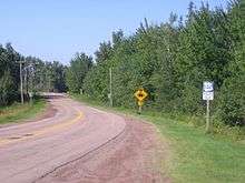
Route 132 outside Dieppe, New Brunswick
The western section is known locally as Champlain Street which consists of a four lane undivided urban arterial. The remainder of the road is a two-lane rural facility. It connects to Route 11 at its eastern terminus and to Route 106 at the western end. Route 132 also provides grade-separated links to Route 2 and Route 15.
Communities
- Dieppe
- Lakeburn
- Malakoff
- Meadow Brook
- Painsec
- Scoudouc and crosses the Scoudouc River
- Shediac
Major destinations
- Moncton International Airport (cargo)
- École Mathieu-Martin
- Scoudouc Industrial Park
gollark: Is what I would be saying, if I didn't write the one using that.
gollark: > -I/usr/include/python3.9Oh no.
gollark: I mean, assuming I can work out what the dependencies are, which may be nontrivial.
gollark: I might need to check all of them locally.
gollark: Yes, physical ones are better.
References
- New Brunswick Department of Transportation: Designated Provincial Highways, 2003
This article is issued from Wikipedia. The text is licensed under Creative Commons - Attribution - Sharealike. Additional terms may apply for the media files.