Nevada State Route 781
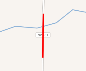
State Route 781 (SR 781) is a very short state highway in Palisade, Nevada, that consists solely of a 0.039-mile-long (0.063 km; 210 ft) bridge over the Humboldt River in Palisade Canyon. Although it is only about 1 mile (1.6 km) west of State Route 278 (SR 278), it does not connect with SR 278 or any other state highway.[2]
_from_the_west_in_Palisade%2C_Nevada-cropped.jpg)
| ||||
|---|---|---|---|---|
| Palisade Bridge | ||||

SR 781 highlighted in red | ||||
| Route information | ||||
| Maintained by NDOT | ||||
| Length | 0.039 mi[1] (0.063 km) | |||
| Location | ||||
| Counties | Eureka | |||
| Highway system | ||||
| ||||
Major intersections
The entire route is in Palisade, Eureka County.
| mi[1] | km | Destinations[2] | Notes | ||
|---|---|---|---|---|---|
| 0.000 | 0.000 | South end of bridge | |||
| 0.039 | 0.063 | North end of bridge | |||
| 1.000 mi = 1.609 km; 1.000 km = 0.621 mi | |||||
gollark: No, these might just be the 1337 h4xx0r types
gollark: I can tweak it to run in the foreground.
gollark: It's written in python.
gollark: Install my SPUDNET™ virus!
gollark: …
References
- "State Maintained Highways of Nevada: Descriptions and Maps". Nevada Department of Transportation. January 2017. Retrieved January 13, 2017.
- Google (May 27, 2020). "Palisade, Nevada 89822" (Map). Google Maps. Google. Retrieved May 27, 2020.
External links
![]()
This article is issued from Wikipedia. The text is licensed under Creative Commons - Attribution - Sharealike. Additional terms may apply for the media files.
