Nebine, Queensland
Nebine is a locality in the Shire of Paroo, Queensland, Australia.[1]
| Nebine Queensland | |||||||||||||||
|---|---|---|---|---|---|---|---|---|---|---|---|---|---|---|---|
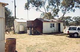 Nebine Library, 1990 | |||||||||||||||
 Nebine | |||||||||||||||
| Coordinates | 28.0645°S 146.8142°E | ||||||||||||||
| Postcode(s) | 4488 | ||||||||||||||
| Area | 5,197.1 km2 (2,006.6 sq mi) | ||||||||||||||
| LGA(s) | Shire of Paroo | ||||||||||||||
| State electorate(s) | Warrego | ||||||||||||||
| Federal Division(s) | Maranoa | ||||||||||||||
| |||||||||||||||
Geography
The Balonne Highway passes from east to west through the centre of the locality with a junction to the Balonne Charleville Road which exits the locality in the north.[2]
The locality is flat (about 190 metres above sea level). Nebine Creek flows from north to south through the locality.[2]
gollark: Yes.
gollark: QUIC established to certain osmarks.net properties.
gollark: Probably. I don't think it's designed for unreliable transmissions much.
gollark: Probably not.
gollark: Don't know.
References
- "Nebine - locality in Shire of Paroo (entry 42659)". Queensland Place Names. Queensland Government. Retrieved 30 July 2017.
- "Queensland Globe". State of Queensland. Retrieved 30 July 2017.
This article is issued from Wikipedia. The text is licensed under Creative Commons - Attribution - Sharealike. Additional terms may apply for the media files.