National Register of Historic Places listings in Winnebago County, Illinois
This is a list of the National Register of Historic Places listings in Winnebago County, Illinois.
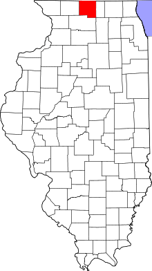
Location of Winnebago County in Illinois
This is intended to be a complete list of the properties and districts on the National Register of Historic Places in Winnebago County, Illinois, United States. Latitude and longitude coordinates are provided for many National Register properties and districts; these locations may be seen together in a map.[1]
There are 37 properties and districts listed on the National Register in the county. Another 2 properties were once listed but have been removed.
- This National Park Service list is complete through NPS recent listings posted August 14, 2020.[2]
Current listings
| [3] | Name on the Register[4] | Image | Date listed[5] | Location | City or town | Description |
|---|---|---|---|---|---|---|
| 1 | Barber–Colman Company Historic District | 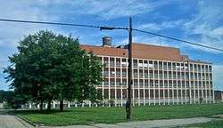 Barber–Colman Company Historic District |
August 8, 2006 (#06000674) |
100 Loomis, 1202-1322 (even) Rock Street 42°15′34″N 89°05′52″W |
Rockford | |
| 2 | Beattie Park Mound Group | 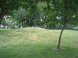 Beattie Park Mound Group |
February 27, 1991 (#91000084) |
North Main Street between Park and Mound Avenues 42°16′28″N 89°05′30″W |
Rockford | |
| 3 | William Brown Building |  William Brown Building |
August 10, 2000 (#00000946) |
226-228 South Main Street 42°16′10″N 89°05′43″W |
Rockford | |
| 4 | Chicago & North Western Railway Stone Arch Bridge | 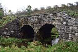 Chicago & North Western Railway Stone Arch Bridge |
August 19, 1993 (#93000840) |
0.6 miles (0.97 km) east of Illinois Route 251, 0.6 miles (0.97 km) west of Interstate 90 and 0.2 miles (0.32 km) south of Burr Oak Road 42°24′57″N 88°59′51″W |
Roscoe Township | |
| 5 | Chick House | 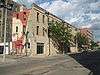 Chick House |
February 7, 1997 (#97000031) |
119-123 South Main Street 42°16′14″N 89°05′43″W |
Rockford | |
| 6 | Condon Brothers and R. H. Shumway Building | 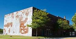 Condon Brothers and R. H. Shumway Building |
August 18, 2015 (#15000524) |
624-642 Cedar St. 42°16′11″N 89°06′09″W |
Rockford | |
| 7 | Coronado | 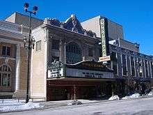 Coronado |
September 6, 1979 (#79000878) |
312-324 North Main Street 42°16′26″N 89°05′35″W |
Rockford | |
| 8 | East Rockford Historic District | 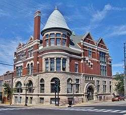 East Rockford Historic District |
March 20, 1980 (#80001422) |
Roughly bounded by Rock River and Market, 4th, and Walnut Streets 42°16′04″N 89°05′16″W |
Rockford | |
| 9 | Garrison–Coronado–Haskell Historic District | 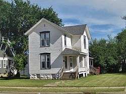 Garrison–Coronado–Haskell Historic District |
January 12, 2012 (#11001030) |
Roughly bounded by Salem, Summer, Main, Court, Whitman, and Winnebago Sts., and Fisher, Ridge, and North Aves. 42°16′55″N 89°05′10″W |
Rockford | |
| 10 | Garrison School | 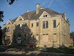 Garrison School |
February 9, 2006 (#06000005) |
1105 North Court Street 42°17′01″N 89°05′09″W |
Rockford | |
| 11 | Graham–Ginestra House | 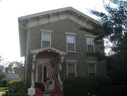 Graham–Ginestra House |
June 11, 1979 (#79000879) |
1115 South Main Street 42°15′42″N 89°06′02″W |
Rockford | |
| 12 | Greenwood Cemetery Chapel and Crematory | 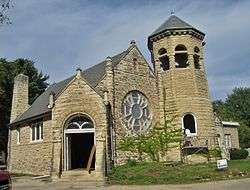 Greenwood Cemetery Chapel and Crematory |
August 28, 2012 (#12000554) |
1011 Auburn St. 42°17′25″N 89°04′40″W |
Rockford | |
| 13 | Haight Village Historic District |  Haight Village Historic District |
November 20, 1987 (#87002044) |
Roughly bounded by Walnut and Kishwaukee Streets, the Chicago Northwestern railroad tracks, and Madison Street 42°15′55″N 89°05′22″W |
Rockford | |
| 14 | Herrick Cobblestone | 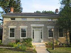 Herrick Cobblestone |
May 14, 1980 (#80001423) |
2127 Broadway 42°15′08″N 89°03′44″W |
Rockford | |
| 15 | Illinois National Guard Armory | 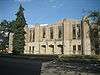 Illinois National Guard Armory |
August 10, 2000 (#00000948) |
605 North Main Street 42°16′37″N 89°05′22″W |
Rockford | |
| 16 | Indian Hill Manor and Farm Historic District | 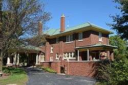 Indian Hill Manor and Farm Historic District |
June 21, 2001 (#01000667) |
6901-7057 Kishwaukee Road 42°10′47″N 89°08′06″W |
Rockford Township | |
| 17 | Lysander Jacoby House | 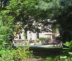 Lysander Jacoby House |
March 5, 1982 (#82002607) |
2 Jacoby Place 42°17′14″N 89°03′45″W |
Rockford | |
| 18 | H.D. Jameson House | 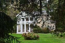 H.D. Jameson House |
September 14, 2003 (#03000915) |
900 North Prairie Street 42°27′46″N 89°04′26″W |
Rockton | |
| 19 | Lake–Peterson House | 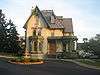 Lake–Peterson House |
June 25, 1980 (#80001424) |
1313 East State Street 42°16′01″N 89°04′28″W |
Rockford | |
| 20 | Kenneth and Phyllis Laurent House | 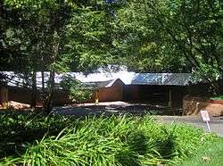 Kenneth and Phyllis Laurent House |
August 28, 2012 (#12000555) |
4646 Spring Brook Rd. 42°17′59″N 89°01′28″W |
Rockford | |
| 21 | Charles Lundberg House | 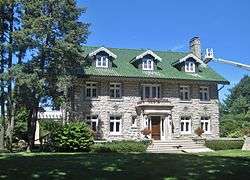 Charles Lundberg House |
December 30, 2008 (#08001251) |
946 N. 2nd St. 42°16′44″N 89°04′40″W |
Rockford | |
| 22 | Macktown Historic District | 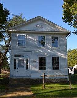 Macktown Historic District |
January 5, 1978 (#78001201) |
West of Rockton on the Pecatonica River 42°27′00″N 89°05′17″W |
Rockton | |
| 23 | Peacock Brewery | 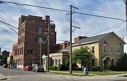 Peacock Brewery |
November 22, 2011 (#11000851) |
200 Prairie and 500 N. Madison Sts. 42°16′23″N 89°05′12″W |
Rockford | |
| 24 | William H. Roberts House | 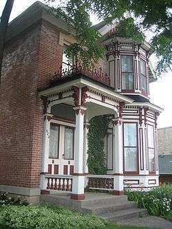 William H. Roberts House |
September 6, 1979 (#79000877) |
523 Main Street 42°18′43″N 89°21′35″W |
Pecatonica | |
| 25 | Rockford Elk's Lodge #64 | 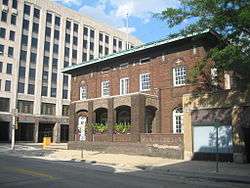 Rockford Elk's Lodge #64 |
February 28, 2005 (#05000113) |
210 West Jefferson 42°16′30″N 89°05′35″W |
Rockford | |
| 26 | Rockford Morning Star Building |  Rockford Morning Star Building |
August 12, 1999 (#99000972) |
127 North Wyman Street 42°16′18″N 89°05′35″W |
Rockford | |
| 27 | Rockton Historic District | 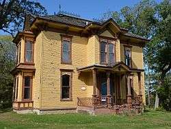 Rockton Historic District |
May 2, 1978 (#78001202) |
Roughly bounded by River, Warren, Cherry, and West Streets 42°27′11″N 89°04′23″W |
Rockton | |
| 28 | St. Thomas Catholic High School for Boys | .jpg) St. Thomas Catholic High School for Boys |
October 4, 2018 (#100002826) |
921 W State 42°16′29″N 89°06′10″W |
Rockford | |
| 29 | Seventh Street Commercial Historic District | 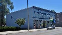 Seventh Street Commercial Historic District |
March 23, 2005 (#04001304) |
Roughly bounded by 7th Street, Charles Street, 6th Street, and Keith Creek 42°15′44″N 89°04′50″W |
Rockford | |
| 30 | Soldiers and Sailors Memorial Hall | 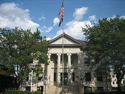 Soldiers and Sailors Memorial Hall |
January 31, 1976 (#76000731) |
211-215 North Main Street 42°16′21″N 89°05′35″W |
Rockford | |
| 31 | Amos Catlin Spafford House | 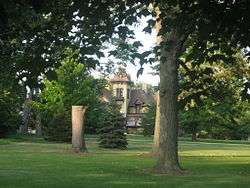 Amos Catlin Spafford House |
February 20, 1980 (#80001425) |
501 North Prospect Street 42°16′21″N 89°03′58″W |
Rockford | |
| 32 | Tinker Swiss Cottage | 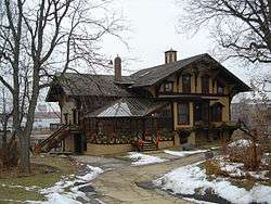 Tinker Swiss Cottage |
December 27, 1972 (#72000468) |
411 Kent Street 42°15′55″N 89°06′07″W |
Rockford | |
| 33 | Turner School | 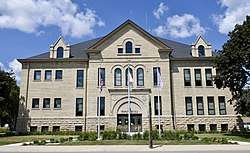 Turner School |
December 29, 2015 (#15000934) |
1410 Broadway 42°15′09″N 89°04′29″W |
Rockford | |
| 34 | Robert Weber Round Barn | 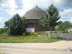 Robert Weber Round Barn |
February 23, 1984 (#84001172) |
East of Durand 42°24′44″N 89°14′11″W |
Durand | |
| 35 | Valencia Court Apartments | 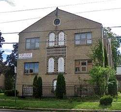 Valencia Court Apartments |
December 22, 2009 (#09001123) |
500-518 Fisher Ave. 42°16′46″N 89°05′32″W |
Rockford | |
| 36 | West Downtown Rockford Historic District | 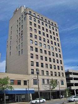 West Downtown Rockford Historic District |
September 5, 2007 (#07000899) |
Roughly bounded by Park Avenue, State Street, Church Street, and Wyman Street 42°16′22″N 89°05′38″W |
Rockford | |
| 37 | Ziock Building | 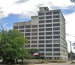 Ziock Building |
May 4, 2011 (#11000246) |
416 S. Main St. 42°16′04″N 89°05′48″W |
Rockford |
Former listings
| [3] | Name on the Register | Image | Date listed | Date removed | Location | City or town | Summary |
|---|---|---|---|---|---|---|---|
| 1 | The Limestones | August 22, 1986 (#86001491) | December 8, 1995 | 118-122 S. Main |
Rockford | ||
| 2 | Svea Music Hall |  Svea Music Hall |
March 19, 1982 (#82002608) | December 8, 1995 | 326 7th St. |
Rockford |
gollark: btw, I use Arch.
gollark: Does this server have MODS™?
gollark: Hi.
gollark: I mean, the big mountain thing and stuff, but no people speaking languages.
gollark: There's not anything very interesting on Mars.
See also
| Wikimedia Commons has media related to National Register of Historic Places in Winnebago County, Illinois. |
References
- The latitude and longitude information provided in this table was derived originally from the National Register Information System, which has been found to be fairly accurate for about 99% of listings. Some locations in this table may have been corrected to current GPS standards.
- "National Register of Historic Places: Weekly List Actions". National Park Service, United States Department of the Interior. Retrieved on August 14, 2020.
- Numbers represent an ordering by significant words. Various colorings, defined here, differentiate National Historic Landmarks and historic districts from other NRHP buildings, structures, sites or objects.
- "National Register Information System". National Register of Historic Places. National Park Service. March 13, 2009.
- The eight-digit number below each date is the number assigned to each location in the National Register Information System database, which can be viewed by clicking the number.
| Topics | |
|---|---|
| Lists by state |
|
| Lists by insular areas | |
| Lists by associated state | |
| Other areas | |
| Related | |
| |
Municipalities and communities of Winnebago County, Illinois, United States | ||
|---|---|---|
| Cities | Map of Illinois highlighting Winnebago County | |
| Villages | ||
| CDP | ||
| Townships | ||
| Unincorporated communities | ||
| Footnotes | ‡This populated place also has portions in an adjacent county or counties | |
This article is issued from Wikipedia. The text is licensed under Creative Commons - Attribution - Sharealike. Additional terms may apply for the media files.