National Register of Historic Places listings in St. Clair County, Illinois
This is a list of the National Register of Historic Places listings in St. Clair County, Illinois.
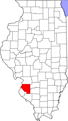
Location of St. Clair County in Illinois
This is intended to be a complete list of the properties and districts on the National Register of Historic Places in St. Clair County, Illinois, United States. Latitude and longitude coordinates are provided for many National Register properties and districts; these locations may be seen together in a map.[1]
There are 30 properties and districts listed on the National Register in the county, including 4 National Historic Landmarks. Another property was once listed but has been removed.
- This National Park Service list is complete through NPS recent listings posted August 14, 2020.[2]
Current listings
| [3] | Name on the Register | Image | Date listed[4] | Location | City or town | Description |
|---|---|---|---|---|---|---|
| 1 | Belleville Historic District | 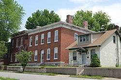 Belleville Historic District |
November 7, 1976 (#76002165) |
Between E, S. Belt, Illinois, and Forest Sts. 38°30′40″N 89°58′44″W |
Belleville | |
| 2 | Berger-Kiel House | 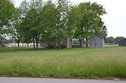 Berger-Kiel House |
August 12, 1999 (#99000977) |
931 N. 6th St. 38°30′00″N 89°48′28″W |
Mascoutah | |
| 3 | Blair Historic District | 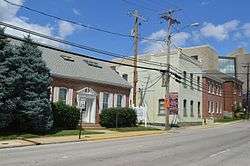 Blair Historic District |
August 18, 2015 (#15000523) |
Parts of 1st, 2nd, 3rd, A, B, High, Illinois, Main, and Washington Sts. 38°30′49″N 89°59′13″W |
Belleville | |
| 4 | Broadview Hotel | 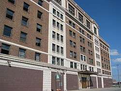 Broadview Hotel |
December 31, 2013 (#13001006) |
415 E. Broadway 38°37′29″N 90°09′39″W |
East St. Louis | |
| 5 | Cahokia Mounds | 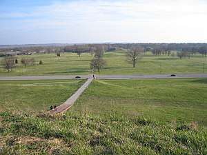 Cahokia Mounds |
October 15, 1966 (#66000899) |
7850 Collinsville Rd., Cahokia Mounds State Park 38°39′12″N 90°03′52″W |
Collinsville | World Heritage Site. Extends into Madison County |
| 6 | Church of the Holy Family | 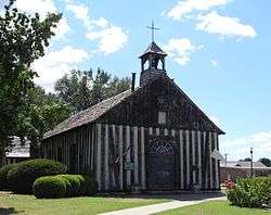 Church of the Holy Family |
April 15, 1970 (#70000851) |
E. 1st St. 38°34′11″N 90°11′18″W |
Cahokia | |
| 7 | Curtiss-Wright Hangars 1 and 2 | 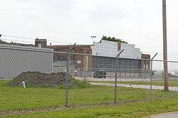 Curtiss-Wright Hangars 1 and 2 |
June 14, 2007 (#06001024) |
2200 Vector Dr., 2300 Vector Dr. 38°34′37″N 90°09′58″W |
Cahokia | |
| 8 | George Draser, Jr., Houses | 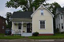 George Draser, Jr., Houses |
May 11, 2000 (#00000474) |
48 and 52 W. Main St. 38°29′24″N 89°47′59″W |
Mascoutah | |
| 9 | Downtown East St. Louis Historic District | .jpg) Downtown East St. Louis Historic District |
September 17, 2014 (#14000622) |
Portions of Collinsville, Missouri, and St. Louis Aves. 38°37′38″N 90°09′32″W |
East St. Louis | |
| 10 | Eads Bridge | 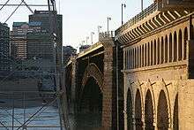 Eads Bridge |
October 15, 1966 (#66000946) |
Spanning the Mississippi River at Washington St. 38°37′41″N 90°10′17″W |
East St. Louis | Connects to St. Louis, Missouri |
| 11 | Emerald Mound and Village Site | 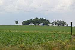 Emerald Mound and Village Site |
October 26, 1971 (#71001026) |
Northwest of the junction of Emerald Mound Grange and Midgley Neiss Rd.[5] 38°37′51″N 89°47′04″W |
Lebanon | |
| 12 | Hotel Belleville | 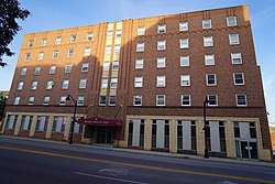 Hotel Belleville |
June 20, 2018 (#100002574) |
16 S Illinois St. 38°30′47″N 89°59′03″W |
Belleville | |
| 13 | Nicholas Jarrot Mansion | 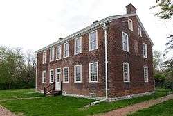 Nicholas Jarrot Mansion |
November 19, 1974 (#74002197) |
124 E. First St. 38°34′12″N 90°11′15″W |
Cahokia | |
| 14 | Knobeloch-Seibert Farm | 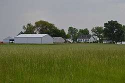 Knobeloch-Seibert Farm |
May 9, 1983 (#83004186) |
Eastern side of Schneider Rd., south of its junction with Illinois Routes 158 and 177[6] 38°29′54″N 89°51′44″W |
Belleville | |
| 15 | Gustave Koerner House | 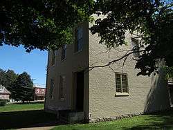 Gustave Koerner House |
September 17, 2004 (#04000983) |
200 Abend St. 38°30′48″N 89°58′40″W |
Belleville | |
| 16 | Lebanon Historic District | 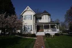 Lebanon Historic District |
October 4, 1978 (#78003113) |
Irregular pattern centered along St. Louis and Belleville Sts. 38°36′06″N 89°48′58″W |
Lebanon | |
| 17 | Lunsford-Pulcher Archeological Site | 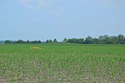 Lunsford-Pulcher Archeological Site |
July 23, 1973 (#73000712) |
Western side of Oklahoma Hill Rd.[7] 38°29′40″N 90°13′52″W |
Columbia | Extends into Monroe County |
| 18 | Majestic Theatre | 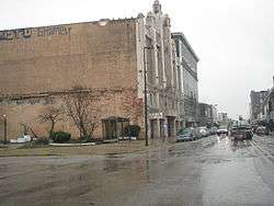 Majestic Theatre |
May 9, 1985 (#85000977) |
240-246 Collinsville Ave. 38°37′38″N 90°09′28″W |
East St. Louis | |
| 19 | Marissa Academy |  Marissa Academy |
October 28, 1994 (#94001267) |
610 S. Main St. 38°14′27″N 89°45′16″W |
Marissa | |
| 20 | Pierre Martin House | 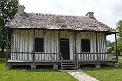 Pierre Martin House |
February 9, 1990 (#89002350) |
First St. at Old Route 3 38°32′50″N 90°11′55″W |
North Dupo | |
| 21 | Mermaid House Hotel | 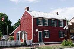 Mermaid House Hotel |
December 4, 1975 (#75002078) |
114 E. St. Louis St. 38°36′13″N 89°48′23″W |
Lebanon | |
| 22 | Old Cahokia Courthouse | 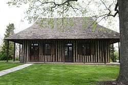 Old Cahokia Courthouse |
November 9, 1972 (#72001480) |
Corner of W. 1st and Elm Sts. 38°34′15″N 90°11′30″W |
Cahokia | |
| 23 | Pennsylvania Avenue Historic District | 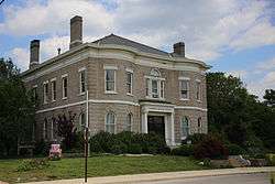 Pennsylvania Avenue Historic District |
July 27, 1979 (#79003166) |
Pennsylvania Ave. 38°37′42″N 90°08′39″W |
East St. Louis | |
| 24 | Rutter Store | 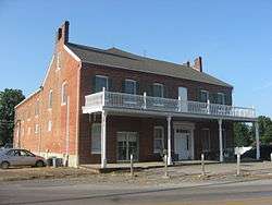 Rutter Store |
May 6, 1994 (#94000436) |
7346 Illinois Route 15 38°21′50″N 89°42′48″W |
St. Libory | |
| 25 | Scott Field Historic District | 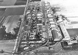 Scott Field Historic District |
March 10, 1994 (#94000060) |
Roughly bounded by Scott Dr. and Hanger Rd. 38°32′22″N 89°51′46″W |
O'Fallon | |
| 26 | Spivey Building | 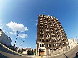 Spivey Building |
January 17, 2002 (#01001462) |
417 Missouri Ave. 38°37′36″N 90°09′32″W |
East St. Louis | |
| 27 | Tiedemann House | May 29, 2020 (#100005233) |
212 West Washington St. 38°35′36″N 89°54′48″W |
O'Fallon | ||
| 28 | Turkey Hill Grange Hall | 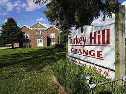 Turkey Hill Grange Hall |
December 27, 2016 (#16000902) |
1375 E. IL 15 38°28′40″N 89°56′23″W |
Belleville | |
| 29 | Union Trust Bank Company Building | 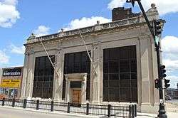 Union Trust Bank Company Building |
May 27, 2014 (#14000255) |
200 Collinsville Ave. 38°37′37″N 90°09′34″W |
East St. Louis | |
| 30 | United States Post Office and Courthouse | 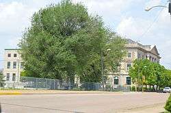 United States Post Office and Courthouse |
August 8, 2014 (#14000478) |
750 Missouri Ave. 38°37′25″N 90°09′24″W |
East St. Louis |
Former listing
| [3] | Name on the Register | Image | Date listed | Date removed | Location | City or town | Summary |
|---|---|---|---|---|---|---|---|
| 1 | St. Clair County Courthouse | St. Clair County Courthouse |
Unknown (#72001564) | 1972 | Public Sq. |
Belleville | Demolished in June 1972[8] |
gollark: ++experimental_qa "Sus law" amogus
gollark: ++magic reload_ext search
gollark: It's not ideal but is the best I can actually run.
gollark: `twmkn9/albert-base-v2-squad2`
gollark: It has to actually initiate first load™ of the model, see.
See also
| Wikimedia Commons has media related to National Register of Historic Places in St. Clair County, Illinois. |
References
- The latitude and longitude information provided in this table was derived originally from the National Register Information System, which has been found to be fairly accurate for about 99% of listings. Some locations in this table may have been corrected to current GPS standards.
- "National Register of Historic Places: Weekly List Actions". National Park Service, United States Department of the Interior. Retrieved on August 14, 2020.
- Numbers represent an ordering by significant words. Various colorings, defined here, differentiate National Historic Landmarks and historic districts from other NRHP buildings, structures, sites or objects.
- The eight-digit number below each date is the number assigned to each location in the National Register Information System database, which can be viewed by clicking the number.
- Reed, Nelson A. National Register of Historic Places Inventory/Nomination: Emerald Mound and Village Site. National Park Service, 1969-09-12, 4.
- Sculle, Keith A., and Michael Ward. National Register of Historic Places Inventory/Nomination: Knobeloch-Seibert Farm. National Park Service, n.d., 9.
- Fowler, Melvin L., and Glen A. Freimuth. National Register of Historic Places Inventory/Nomination: Lunsford-Pulcher Archeological Site. National Park Service, n.d., 4.
| Topics | |
|---|---|
| Lists by state |
|
| Lists by insular areas | |
| Lists by associated state | |
| Other areas | |
| Related | |
| |
Municipalities and communities of St. Clair County, Illinois, United States | ||
|---|---|---|
| Cities | Map of Illinois highlighting St. Clair County | |
| Villages | ||
| Townships | ||
| CDPs | ||
| Other unincorporated communities | ||
| Footnotes | ‡This populated place also has portions in an adjacent county or counties | |
This article is issued from Wikipedia. The text is licensed under Creative Commons - Attribution - Sharealike. Additional terms may apply for the media files.