National Register of Historic Places listings in Santa Cruz County, Arizona
This is a list of the National Register of Historic Places listings in Santa Cruz County, Arizona. It is intended to be a complete list of the properties and districts on the National Register of Historic Places in Santa Cruz County, Arizona, United States. The locations of National Register properties and districts for which the latitude and longitude coordinates are included below, may be seen in a map.[1]
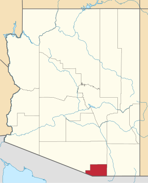
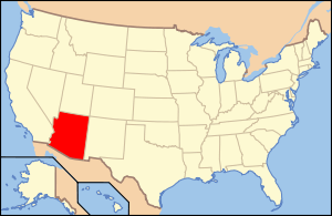
Location of Santa Cruz County in Arizona
There are 53 properties and districts listed on the National Register in the county, including 3 that are also National Historic Landmarks.
- This National Park Service list is complete through NPS recent listings posted August 14, 2020.[2]
Current listings
| [3] | Name on the Register | Image | Date listed[4] | Location | City or town | Description |
|---|---|---|---|---|---|---|
| 1 | 10 Cottages on Short Street | .JPG) 10 Cottages on Short Street |
August 29, 1985 (#85001873) |
Short Street[5] 31°20′00″N 110°56′16″W |
Nogales | |
| 2 | Arizona-Sonora Manufacturing Company Machine Shop | 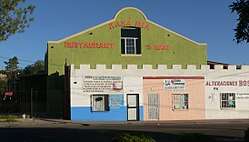 Arizona-Sonora Manufacturing Company Machine Shop |
August 29, 1985 (#85001851) |
Grand Ave. at Arroyo Boulevard 31°20′24″N 110°56′17″W |
Nogales | |
| 3 | Atascosa Lookout House | January 28, 1988 (#87002462) |
Coronado National Forest 31°25′33″N 111°08′47″W |
Tubac | Lookout cabin destroyed, other structures damaged by 2011 fire[6] | |
| 4 | Barrio de Tubac Archeological District | September 12, 2003 (#03000912) |
Address Restricted |
Tubac | ||
| 5 | Bowman Hotel | _2.JPG) Bowman Hotel |
August 29, 1985 (#85001852) |
245 Grand Ave.[5] 31°20′13″N 110°56′24″W |
Nogales | |
| 6 | W.G. Bowman House | _2.JPG) W.G. Bowman House |
August 29, 1985 (#85001850) |
613 Sierra[5] 31°20′34″N 110°56′13″W |
Nogales | |
| 7 | Burton Building | Burton Building |
August 29, 1985 (#85001848) |
253 Grand Ave.[5] 31°20′14″N 110°56′24″W |
Nogales | |
| 8 | Cady Hall | Cady Hall |
December 2, 1992 (#92001635) |
346 Duquesne 31°32′20″N 110°45′14″W |
Patagonia | Now the Patagonia Public Library.[7] |
| 9 | Calabasas | 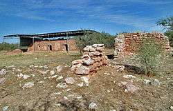 Calabasas |
June 3, 1971 (#71000118) |
North of Nogales 31°27′09″N 110°57′34″W |
Rio Rico | |
| 10 | Canelo Ranger Station | 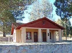 Canelo Ranger Station |
June 10, 1993 (#93000513) |
Forest Rd. 52B north of Canelo in the Coronado National Forest 31°33′05″N 110°30′59″W |
Canelo | |
| 11 | Canelo School | 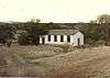 Canelo School |
July 31, 1991 (#91000981) |
18 miles southeast of Sonoita on State Route 93 31°32′32″N 110°30′36″W |
Canelo | |
| 12 | Frank F. Cranz House | Frank F. Cranz House |
August 29, 1985 (#85001849) |
321 Arroyo[5] 31°20′19″N 110°56′25″W |
Nogales | |
| 13 | Crawford Hill Historic Residential District | 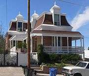 Crawford Hill Historic Residential District |
August 29, 1985 (#85001874) |
Roughly bounded by Oak St., Terrace Ave., Compound St., and Interstate 19 and Grindell 31°20′07″N 110°56′12″W |
Nogales | |
| 14 | George Dunbar House | .JPG) George Dunbar House |
August 29, 1985 (#85001853) |
605 Sierra[5] 31°20′34″N 110°56′14″W |
Nogales | |
| 15 | James Finley House | 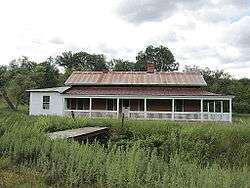 James Finley House |
November 19, 1974 (#74000462) |
7.2 miles southwest of Patagonia in the Coronado National Forest 31°27′55″N 110°42′24″W |
Harshaw | |
| 16 | Guevavi Mission Ruins | 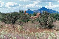 Guevavi Mission Ruins |
November 5, 1971 (#71000119) |
6 miles north of U.S./Mexico border 31°24′36″N 110°54′10″W |
Nogales | |
| 17 | Sen. James A. Harrison House | .JPG) Sen. James A. Harrison House |
August 29, 1985 (#85001854) |
Morley Avenue[5] 31°20′17″N 110°56′12″W |
Nogales | |
| 18 | Hotel Blanca | Hotel Blanca |
August 29, 1985 (#85001861) |
456 Morley Avenue[5] 31°20′26″N 110°56′04″W |
Nogales | |
| 19 | House at 220 Walnut Street | .JPG) House at 220 Walnut Street |
August 29, 1985 (#85001856) |
365 Walnut St.[5] 31°20′21″N 110°56′32″W |
Nogales | |
| 20 | House at 334-338 Walnut Street | House at 334-338 Walnut Street |
August 29, 1985 (#85001857) |
459-465 Walnut St.[5] 31°20′24″N 110°56′39″W |
Nogales | |
| 21 | House at 665 Morley Avenue | House at 665 Morley Avenue |
August 29, 1985 (#85001858) |
Morley Avenue[5] 31°20′25″N 110°56′04″W |
Nogales | |
| 22 | Kentucky Camp Historic District | 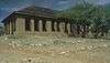 Kentucky Camp Historic District |
November 22, 1995 (#95001312) |
Near Forest Road 163 off State Route 83[8] 31°44′13″N 110°43′43″W |
Coronado National Forest | |
| 23 | Pete Kitchen Ranch | 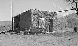 Pete Kitchen Ranch |
February 20, 1975 (#75000360) |
3.5 miles north of Nogales off U.S. Route 89 31°24′08″N 110°57′16″W |
Nogales | |
| 24 | S.H. Kress & Co. Building | _2.JPG) S.H. Kress & Co. Building |
August 29, 1985 (#85001859) |
48 N. Morley Ave.[5] 31°20′01″N 110°56′27″W |
Nogales | |
| 25 | Las Dos Naciones Cigar Factory | _1.JPG) Las Dos Naciones Cigar Factory |
August 29, 1985 (#85001860) |
204 Morley Ave.[5] 31°20′09″N 110°56′20″W |
Nogales | |
| 26 | The Little Outfit Schoolhouse | 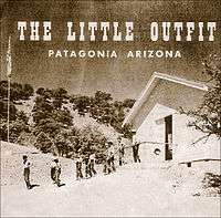 The Little Outfit Schoolhouse |
January 8, 2009 (#08001275) |
571 Canelo Pass Road 31°29′43″N 110°34′25″W |
Patagonia | Ranch school opened 1940, grades 3 to 8, teaching ideals of the West |
| 27 | Marsh Heights Historic District | Marsh Heights Historic District |
October 29, 1985 (#85003407) |
Roughly bounded by Court St., Summit Ave., S. Court St., and Morley Ave. 31°20′09″N 110°56′38″W |
Nogales | |
| 28 | George B. Marsh Building | George B. Marsh Building |
August 29, 1985 (#85001855) |
142-154 Grand Ave.[5] 31°20′07″N 110°56′26″W |
Nogales | |
| 29 | Mediterranean Style House | Mediterranean Style House |
August 29, 1985 (#85001863) |
215 Walnut Street[5] 31°20′18″N 110°56′27″W |
Nogales | |
| 30 | Mediterranean Style House | Mediterranean Style House |
August 29, 1985 (#85001862) |
245 Walnut Street[5] 31°20′19″N 110°56′28″W |
Nogales | |
| 31 | Hugo Miller House | .JPG) Hugo Miller House |
August 29, 1985 (#85001864) |
565 Potrero[5] 31°20′33″N 110°56′08″W |
Nogales | |
| 32 | Montezuma Hotel | _2.JPG) Montezuma Hotel |
August 29, 1985 (#85001867) |
108–120 Morley Avenue[5] 31°20′03″N 110°56′25″W |
Nogales | |
| 33 | Nogales Electric Light, Ice & Water Company Power House | Nogales Electric Light, Ice & Water Company Power House |
August 29, 1985 (#85001865) |
491 Grand Avenue[5] 31°20′26″N 110°56′14″W |
Nogales | |
| 34 | Nogales High School | 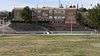 Nogales High School |
August 29, 1985 (#85001866) |
310 W. Plum St.[5] 31°20′25″N 110°56′28″W |
Nogales | |
| 35 | Nogales Steam Laundry Building | .JPG) Nogales Steam Laundry Building |
August 29, 1985 (#85001868) |
223-219 East 31°20′03″N 110°56′19″W |
Nogales | |
| 36 | A.S. Noon Building | _1.JPG) A.S. Noon Building |
August 29, 1985 (#85001871) |
185 Grand Avenue[5] 31°20′11″N 110°56′26″W |
Nogales | |
| 37 | Old Nogales City Hall and Fire Station | 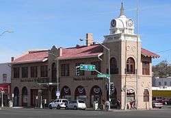 Old Nogales City Hall and Fire Station |
April 3, 1980 (#80000772) |
136 Grand Avenue[5] 31°20′05″N 110°56′27″W |
Nogales | |
| 38 | Old Tubac Schoolhouse | Old Tubac Schoolhouse |
November 10, 1970 (#70000115) |
Tubac Presidio State Historic Park[9] 31°36′43″N 111°02′48″W |
Tubac | |
| 39 | Pennington Rural Historic Landscape | February 10, 2000 (#00000004) |
North of the junction of Royal Rd. and Calle Del Rio 31°20′55″N 110°50′52″W |
Nogales | ||
| 40 | Jose Piscorski Building | Jose Piscorski Building |
August 29, 1985 (#85001870) |
186–190 Morley Avenue[5] 31°20′08″N 110°56′21″W |
Nogales | |
| 41 | Ruby | 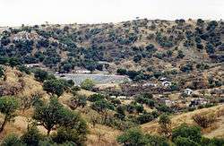 Ruby |
April 28, 1975 (#75000361) |
North of the U.S./Mexico border between Ruby and Montana peaks 31°29′01″N 111°14′14″W |
Ruby | |
| 42 | San Rafael Ranch Historic District | 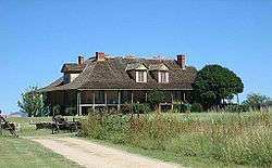 San Rafael Ranch Historic District |
February 7, 2008 (#08000001) |
San Rafael Valley 31°21′14″N 110°36′47″W |
Lochiel | |
| 43 | Santa Cruz Bridge No. 1 | 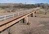 Santa Cruz Bridge No. 1 |
September 30, 1988 (#88001635) |
South River Rd. over the Santa Cruz River 31°23′20″N 110°52′28″W |
Nogales | |
| 44 | Santa Cruz County Courthouse | 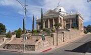 Santa Cruz County Courthouse |
December 7, 1977 (#77000239) |
Court Street and Morley Avenue 31°20′11″N 110°56′16″W |
Nogales | |
| 45 | Three Mediterranean Cottages on Pajarito Street | 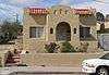 Three Mediterranean Cottages on Pajarito Street |
August 29, 1985 (#85001872) |
141 and 147 Pajarito, 533 Portrero[5] 31°20′30″N 110°56′11″W |
Nogales | |
| 46 | Tubac Presidio | 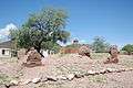 Tubac Presidio |
December 2, 1970 (#70000116) |
Broadway and River Rd. 31°36′44″N 111°02′47″W |
Tubac | |
| 47 | Tubac Townsite Historic District |  Tubac Townsite Historic District |
October 17, 1994 (#94001195) |
Roughly bounded by Tubac and Plaza Rds. and Presidio Dr. 31°36′44″N 111°02′43″W |
Tubac | |
| 48 | Tumacacori Museum | 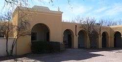 Tumacacori Museum |
May 28, 1987 (#87001437) |
Tumacácori National Historical Park 31°34′04″N 111°03′04″W |
Tumacacori | |
| 49 | Tumacacori National Monument | 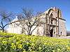 Tumacacori National Monument |
October 15, 1966 (#66000193) |
18 miles (29 km) north of Nogales on Interstate 19 31°34′07″N 111°03′03″W |
Tumacacori | Mission site that was declared a National Monument and has since been converted to a National Historical Park |
| 50 | US Custom House | US Custom House |
August 6, 1987 (#87001344) |
Junction of International and Terrace Sts. 31°19′59″N 110°56′36″W |
Nogales | |
| 51 | U.S. Custom House and U.S. Inspection Office, Morley Gate-Nogales, Arizona | 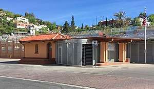 U.S. Custom House and U.S. Inspection Office, Morley Gate-Nogales, Arizona |
August 9, 2016 (#14000244) |
International St. at Morley Ave. 31°19′58″N 110°56′29″W |
Nogales | |
| 52 | US Post Office and Immigration Station-Nogales Main | 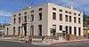 US Post Office and Immigration Station-Nogales Main |
December 3, 1985 (#85003107) |
Hudgin St. and Morley Ave. 31°20′15″N 110°56′14″W |
Nogales | |
| 53 | J.E. Wise Building | .JPG) J.E. Wise Building |
August 29, 1985 (#85001869) |
87 N. Grand Avenue[5] 31°20′04″N 110°56′30″W |
Nogales |
gollark: The garland SAlts are very cool.
gollark: That's not even very weird.
gollark: ⚡
gollark: Sorcery.
gollark: Wait, how do you have *two*?
See also
| Wikimedia Commons has media related to National Register of Historic Places in Santa Cruz County, Arizona. |
References
- The latitude and longitude information provided in this table was derived originally from the National Register Information System, which has been found to be fairly accurate for about 99% of listings. Some locations in this table may have been corrected to current GPS standards.
- "National Register of Historic Places: Weekly List Actions". National Park Service, United States Department of the Interior. Retrieved on August 14, 2020.
- Numbers represent an ordering by significant words. Various colorings, defined here, differentiate National Historic Landmarks and historic districts from other NRHP buildings, structures, sites or objects.
- The eight-digit number below each date is the number assigned to each location in the National Register Information System database, which can be viewed by clicking the number.
- "Descriptions of Important Historic Sites". Archaeology Southwest. Retrieved 2012-03-02.
- "Burned-area report". July 7, 2011. Retrieved April 17, 2016.
- Bunker, Lisa Waite. "Library History". Patagonia Public Library. Retrieved 2012-03-01.
- Location derived from this Tucson Weekly article; the NRIS lists the site as "Address Restricted"
- Eatherly, Charles R. "History of Tubac Presidio State Historic Park". Tubac Presidio State Historic Park. Retrieved 2012-03-01.
 | |||
Municipalities and communities of Santa Cruz County, Arizona, United States | ||
|---|---|---|
| City | | |
| Town | ||
| CDPs | ||
| Populated places | ||
| Ghost towns | ||
This article is issued from Wikipedia. The text is licensed under Creative Commons - Attribution - Sharealike. Additional terms may apply for the media files.