National Register of Historic Places listings in Northampton County, Virginia
This is a list of the National Register of Historic Places listings in Northampton County, Virginia.
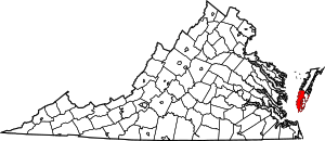
Location of Northampton County in Virginia
This is intended to be a complete list of the properties and districts on the National Register of Historic Places in Northampton County, Virginia, United States. The locations of National Register properties and districts for which the latitude and longitude coordinates are included below, may be seen in a Google map.[1]
There are 27 properties and districts listed on the National Register in the county, including 2 National Historic Landmarks. Another 3 properties were once listed but have been removed.
- This National Park Service list is complete through NPS recent listings posted August 14, 2020.[2]
Current listings
| [3] | Name on the Register[4] | Image | Date listed[5] | Location | City or town | Description |
|---|---|---|---|---|---|---|
| 1 | Almshouse Farm at Machipongo | 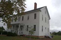 Almshouse Farm at Machipongo |
April 1, 2002 (#02000317) |
12402 U.S. Route 13 37°24′16″N 75°54′18″W |
Machipongo | |
| 2 | Arlington Archeological Site | 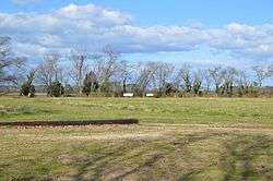 Arlington Archeological Site |
May 12, 2008 (#08000422) |
Address Restricted |
Capeville | |
| 3 | Benjamin's Department Store | 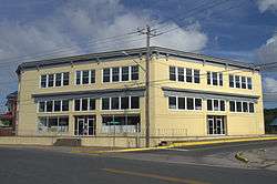 Benjamin's Department Store |
May 10, 2006 (#06000367) |
3327 Main St. 37°31′49″N 75°49′20″W |
Exmore | |
| 4 | James Brown's Dry Goods Store | 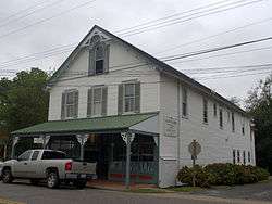 James Brown's Dry Goods Store |
April 1, 2002 (#02000321) |
16464 Courthouse Rd. 37°21′07″N 75°56′48″W |
Eastville | |
| 5 | Brownsville | .jpg) Brownsville |
February 26, 1970 (#70000819) |
East of the junction of Seaside and Brownsville Rds. 37°28′24″N 75°49′24″W |
Nassawadox | |
| 6 | Cape Charles Historic District | 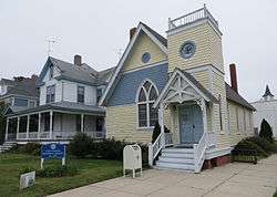 Cape Charles Historic District |
January 3, 1991 (#90002122) |
Roughly bounded by Washington, Bay, and Mason Aves., and Fig St. 37°16′11″N 76°00′59″W |
Cape Charles | |
| 7 | Cape Charles Light Station | 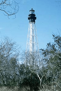 Cape Charles Light Station |
June 23, 2003 (#03000569) |
Smith Island 37°07′22″N 75°54′24″W |
Kiptopeke | |
| 8 | Cessford | .jpg) Cessford |
January 16, 2004 (#03001441) |
16546 Courthouse Rd. 37°20′59″N 75°56′53″W |
Eastville | |
| 9 | John W. Chandler House | 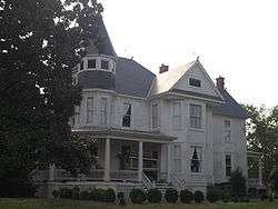 John W. Chandler House |
November 27, 2004 (#04001270) |
3342 Main St. 37°31′48″N 75°49′24″W |
Exmore | |
| 10 | Custis Tombs | 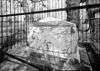 Custis Tombs |
April 17, 1970 (#70000815) |
Arlington Chase Rd. 37°13′45″N 76°00′13″W |
Cheapside | |
| 11 | Eastville Historic District | 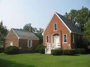 Eastville Historic District |
October 1, 2009 (#09000795) |
Area includes U.S. Route 13, Old Town Neck Dr., Courthouse Rd., Willow Oak Rd., Rockefellow La., and Stumptown Dr. 37°21′10″N 75°56′44″W |
Eastville | |
| 12 | Eastville Mercantile | 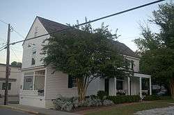 Eastville Mercantile |
January 20, 2005 (#04001540) |
16429 Courthouse Rd. 37°21′10″N 75°56′46″W |
Eastville | |
| 13 | Eyre Hall | .jpg) Eyre Hall |
November 12, 1969 (#69000265) |
West of U.S. Route 13 37°18′48″N 75°58′54″W |
Cheriton | |
| 14 | Glebe of Hungar's Parish | February 26, 1970 (#70000817) |
Northwest of the junction of Glebe and Church Neck Rds. 37°27′38″N 75°57′34″W |
Franktown | ||
| 15 | Grapeland |  Grapeland |
May 6, 1980 (#80004207) |
Grapeland Circle, north of Wardtown[6] 37°32′40″N 75°52′54″W |
Wardtown | |
| 16 | Hungars Church | .jpg) Hungars Church |
October 15, 1970 (#70000813) |
East of the junction of Bayside and Church Neck Rds. 37°26′47″N 75°55′26″W |
Bridgetown | |
| 17 | Kendall Grove | .jpg) Kendall Grove |
June 21, 1982 (#82004576) |
Kendall Grove Rd. 37°22′56″N 75°56′34″W |
Eastville | |
| 18 | Northampton County Courthouse Historic District | 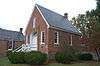 Northampton County Courthouse Historic District |
April 13, 1972 (#72001410) |
East along U.S. Route 13 and extending 0.1 miles (0.16 km) to the west, north, and south from its intersection with Willow Oak Rd. 37°21′12″N 75°56′48″W |
Eastville | |
| 19 | Northampton Lumber Company Historic District |  Northampton Lumber Company Historic District |
May 29, 2008 (#08000480) |
Junction of U.S. Route 13 and Mill St. 37°28′24″N 75°51′30″W |
Nassawadox | |
| 20 | Oak Grove | February 4, 1993 (#93000006) |
Northern side of Old Town Neck Dr., 1 mile (1.6 km) west of the junction with US 13 37°23′16″N 75°57′23″W |
Eastville | ||
| 21 | Pear Valley | 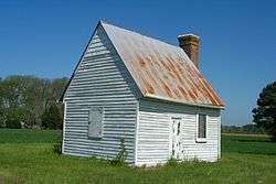 Pear Valley |
November 12, 1969 (#69000266) |
South of the junction of Wilsonia Neck and Pear Cottage Drs. 37°23′48″N 75°55′22″W |
Eastville | |
| 22 | Selma | 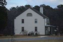 Selma |
May 10, 2006 (#06000368) |
16237 Courthouse Rd. 37°21′25″N 75°56′32″W |
Eastville | |
| 23 | Stratton Manor | .jpg) Stratton Manor |
November 28, 1980 (#80004206) |
Southeast of Cape Charles off Parsons Circle 37°15′42″N 75°59′00″W |
Cape Charles | |
| 24 | Upper Ridge Site | August 23, 2005 (#05000914) |
Atlantic Ocean beach[7] 37°13′19″N 75°53′04″W |
Mockhorn Island | ||
| 25 | Vaucluse | .jpg) Vaucluse |
September 15, 1970 (#70000814) |
South of the junction of Church Neck and Sparrow Pt. Rds. 37°25′05″N 75°58′23″W |
Bridgetown | |
| 26 | Westerhouse House | November 19, 1974 (#74002139) |
West of Bridgetown off Church Neck Rd. 37°26′52″N 75°58′06″W |
Bridgetown | ||
| 27 | Winona | 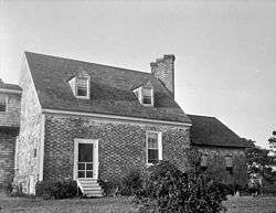 Winona |
October 1, 1969 (#69000264) |
Southwest of the junction of Glebe and Church Neck Rds. 37°26′25″N 75°56′08″W |
Bridgetown |
Former listings
| [3] | Name on the Register | Image | Date listed | Date removed | Location | City or town | Summary |
|---|---|---|---|---|---|---|---|
| 1 | Caserta |  Caserta |
February 26, 1970 (#70000816) | March 19, 2001 | NW of junction of Routes 630 and US 13 |
Eastville | Destroyed by fire in 1975 |
| 2 | Somers House |  Somers House |
February 26, 1970 (#70000818) | June 10, 2005 | SE of jct. of Rtes. 183 and 691 |
Jamesville | Demolished |
| 3 | Westover |  Westover |
June 28, 1982 (#82004577) | March 19, 2001 | VA 630 |
Eastville | Destroyed by fire |
gollark: With sufficient batteries ANY machine can run on 4RF/t!
gollark: Admittedly they don't produce much.
gollark: Isn't that basically just the decay generators?
gollark: That reminds me, I should build one of the MSFRs.
gollark: That *is* basically what they do now, but probably not realistically.
See also
| Wikimedia Commons has media related to National Register of Historic Places in Northampton County, Virginia. |
References
- The latitude and longitude information provided in this table was derived originally from the National Register Information System, which has been found to be fairly accurate for about 99% of listings. Some locations in this table may have been corrected to current GPS standards.
- "National Register of Historic Places: Weekly List Actions". National Park Service, United States Department of the Interior. Retrieved on August 14, 2020.
- Numbers represent an ordering by significant words. Various colorings, defined here, differentiate National Historic Landmarks and historic districts from other NRHP buildings, structures, sites or objects.
- "National Register Information System". National Register of Historic Places. National Park Service. April 24, 2008.
- The eight-digit number below each date is the number assigned to each location in the National Register Information System database, which can be viewed by clicking the number.
- Location derived from its coordinates; the NRIS lists the site as "Address Restricted" but provides coordinates
- Egloff, Keith T. National Register of Historic Places Inventory/Nomination: Upper Ridge Site. National Park Service, 2005-05, 20.

This article is issued from Wikipedia. The text is licensed under Creative Commons - Attribution - Sharealike. Additional terms may apply for the media files.